You are here: Home > Network List > UW - Pacific Northwest Regional Seismic Network Stations List
> Station HOOD Mt Hood Meadows, OR CREST BB SMO > Earthquake Result Viewer
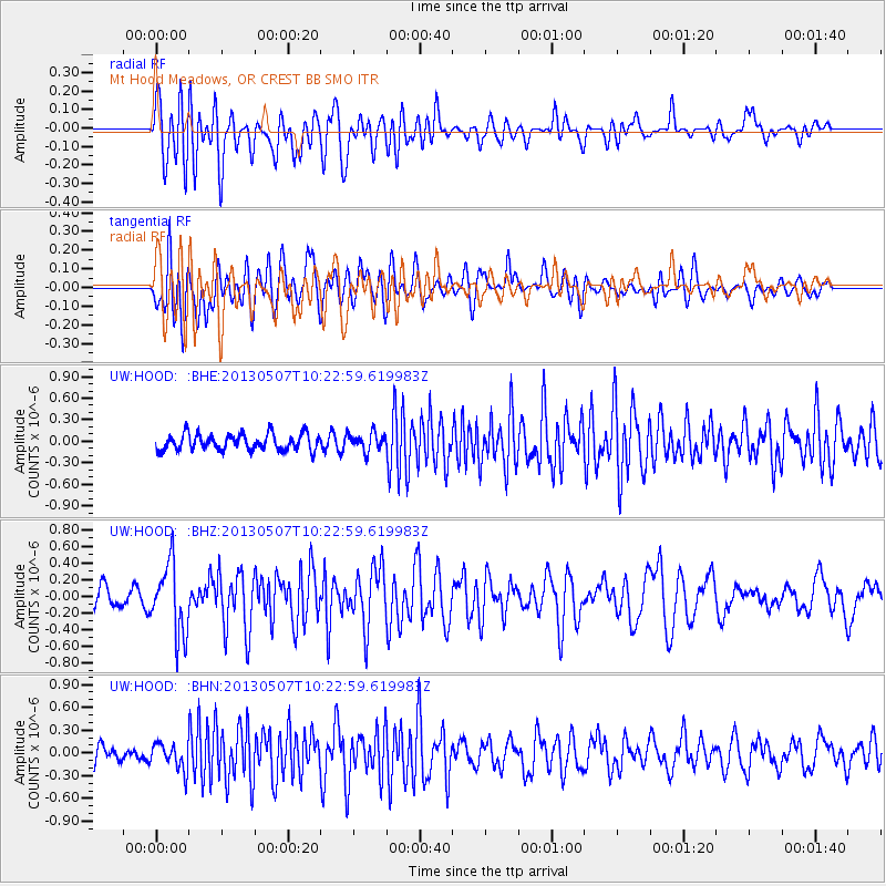
HOOD Mt Hood Meadows, OR CREST BB SMO - Earthquake Result Viewer
*The percent match for this event was below the threshold and hence no stack was calculated.
| Earthquake location: |
South Of Fiji Islands |
| Earthquake latitude/longitude: |
-19.6/175.1 |
| Earthquake time(UTC): |
2013/05/07 (127) 10:10:48 GMT |
| Earthquake Depth: |
11 km |
| Earthquake Magnitude: |
5.6 MB, 5.7 MS, 6.0 MW, 5.9 MW |
| Earthquake Catalog/Contributor: |
WHDF/NEIC |
|
| Network: |
UW Pacific Northwest Regional Seismic Network |
| Station: |
HOOD Mt Hood Meadows, OR CREST BB SMO |
| Lat/Lon: |
45.32 N/121.65 W |
| Elevation: |
1520 m |
|
| Distance: |
86.4 deg |
| Az: |
39.16 deg |
| Baz: |
237.536 deg |
| Ray Param: |
$rayparam |
*The percent match for this event was below the threshold and hence was not used in the summary stack. |
|
| Radial Match: |
73.887054 % |
| Radial Bump: |
400 |
| Transverse Match: |
73.193596 % |
| Transverse Bump: |
400 |
| SOD ConfigId: |
508211 |
| Insert Time: |
2013-07-12 08:27:56.511 +0000 |
| GWidth: |
2.5 |
| Max Bumps: |
400 |
| Tol: |
0.001 |
|
Signal To Noise
| Channel | StoN | STA | LTA |
| UW:HOOD: :BHZ:20130507T10:22:59.619983Z | 3.6596675 | 4.2405838E-7 | 1.1587347E-7 |
| UW:HOOD: :BHN:20130507T10:22:59.619983Z | 1.5010624 | 1.7533314E-7 | 1.1680603E-7 |
| UW:HOOD: :BHE:20130507T10:22:59.619983Z | 1.0773973 | 1.214773E-7 | 1.1275069E-7 |
| Arrivals |
| Ps | |
| PpPs | |
| PsPs/PpSs | |


