You are here: Home > Network List > TA - USArray Transportable Network (new EarthScope stations) Stations List
> Station W53A Cullowhee, NC, USA > Earthquake Result Viewer
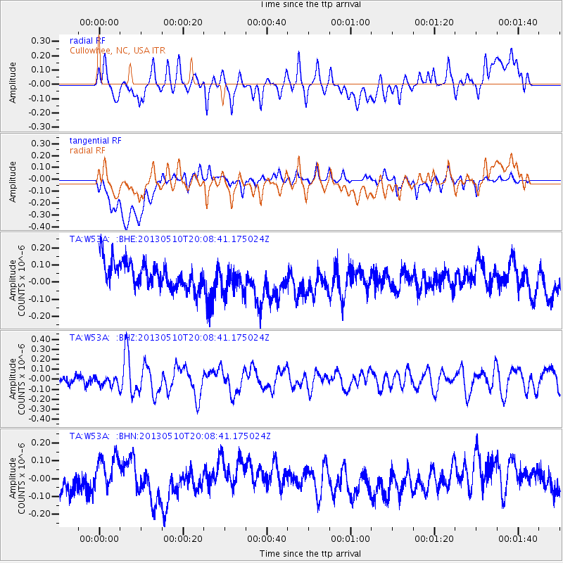
W53A Cullowhee, NC, USA - Earthquake Result Viewer
*The percent match for this event was below the threshold and hence no stack was calculated.
| Earthquake location: |
Southern Mid-Atlantic Ridge |
| Earthquake latitude/longitude: |
-29.0/-13.2 |
| Earthquake time(UTC): |
2013/05/10 (130) 19:56:04 GMT |
| Earthquake Depth: |
3.9 km |
| Earthquake Magnitude: |
5.5 MB, 5.6 MS, 5.7 MW, 5.7 MW |
| Earthquake Catalog/Contributor: |
WHDF/NEIC |
|
| Network: |
TA USArray Transportable Network (new EarthScope stations) |
| Station: |
W53A Cullowhee, NC, USA |
| Lat/Lon: |
35.17 N/83.16 W |
| Elevation: |
1180 m |
|
| Distance: |
91.7 deg |
| Az: |
309.656 deg |
| Baz: |
124.581 deg |
| Ray Param: |
$rayparam |
*The percent match for this event was below the threshold and hence was not used in the summary stack. |
|
| Radial Match: |
32.923306 % |
| Radial Bump: |
400 |
| Transverse Match: |
37.814686 % |
| Transverse Bump: |
400 |
| SOD ConfigId: |
508211 |
| Insert Time: |
2013-07-12 08:35:39.293 +0000 |
| GWidth: |
2.5 |
| Max Bumps: |
400 |
| Tol: |
0.001 |
|
Signal To Noise
| Channel | StoN | STA | LTA |
| TA:W53A: :BHZ:20130510T20:08:41.175024Z | 0.85340923 | 4.872696E-8 | 5.709683E-8 |
| TA:W53A: :BHN:20130510T20:08:41.175024Z | 1.7424726 | 1.1652403E-7 | 6.687281E-8 |
| TA:W53A: :BHE:20130510T20:08:41.175024Z | 1.0479795 | 7.957613E-8 | 7.593292E-8 |
| Arrivals |
| Ps | |
| PpPs | |
| PsPs/PpSs | |


