You are here: Home > Network List > CI - Caltech Regional Seismic Network Stations List
> Station SMM Simmler, CA, USA > Earthquake Result Viewer
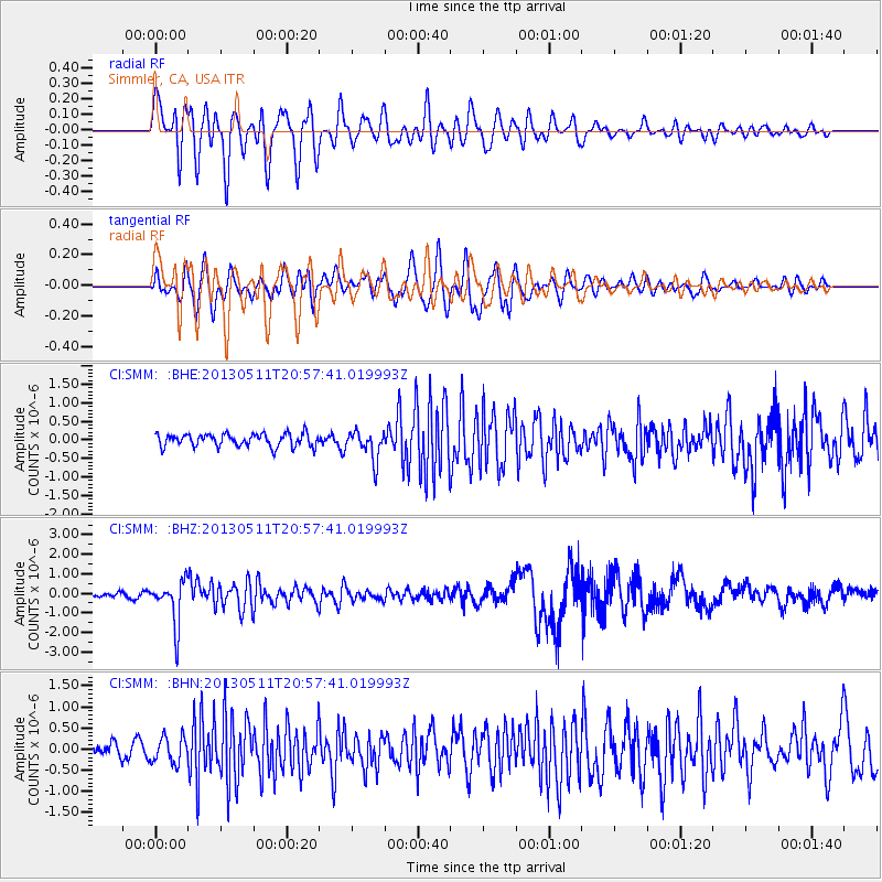
SMM Simmler, CA, USA - Earthquake Result Viewer
*The percent match for this event was below the threshold and hence no stack was calculated.
| Earthquake location: |
Tonga Islands |
| Earthquake latitude/longitude: |
-18.0/-175.1 |
| Earthquake time(UTC): |
2013/05/11 (131) 20:46:57 GMT |
| Earthquake Depth: |
213 km |
| Earthquake Magnitude: |
5.8 MB, 6.4 MW, 6.4 MW |
| Earthquake Catalog/Contributor: |
WHDF/NEIC |
|
| Network: |
CI Caltech Regional Seismic Network |
| Station: |
SMM Simmler, CA, USA |
| Lat/Lon: |
35.31 N/120.00 W |
| Elevation: |
599 m |
|
| Distance: |
74.4 deg |
| Az: |
44.144 deg |
| Baz: |
234.156 deg |
| Ray Param: |
$rayparam |
*The percent match for this event was below the threshold and hence was not used in the summary stack. |
|
| Radial Match: |
79.30421 % |
| Radial Bump: |
400 |
| Transverse Match: |
70.07505 % |
| Transverse Bump: |
400 |
| SOD ConfigId: |
508211 |
| Insert Time: |
2013-07-12 08:54:46.869 +0000 |
| GWidth: |
2.5 |
| Max Bumps: |
400 |
| Tol: |
0.001 |
|
Signal To Noise
| Channel | StoN | STA | LTA |
| CI:SMM: :BHZ:20130511T20:57:41.019993Z | 8.0832205 | 1.1278204E-6 | 1.3952612E-7 |
| CI:SMM: :BHN:20130511T20:57:41.019993Z | 1.6554312 | 3.092724E-7 | 1.8682286E-7 |
| CI:SMM: :BHE:20130511T20:57:41.019993Z | 2.3180733 | 3.9688075E-7 | 1.7121148E-7 |
| Arrivals |
| Ps | |
| PpPs | |
| PsPs/PpSs | |


