You are here: Home > Network List > US - United States National Seismic Network Stations List
> Station MSO Missoula, Montana, USA > Earthquake Result Viewer
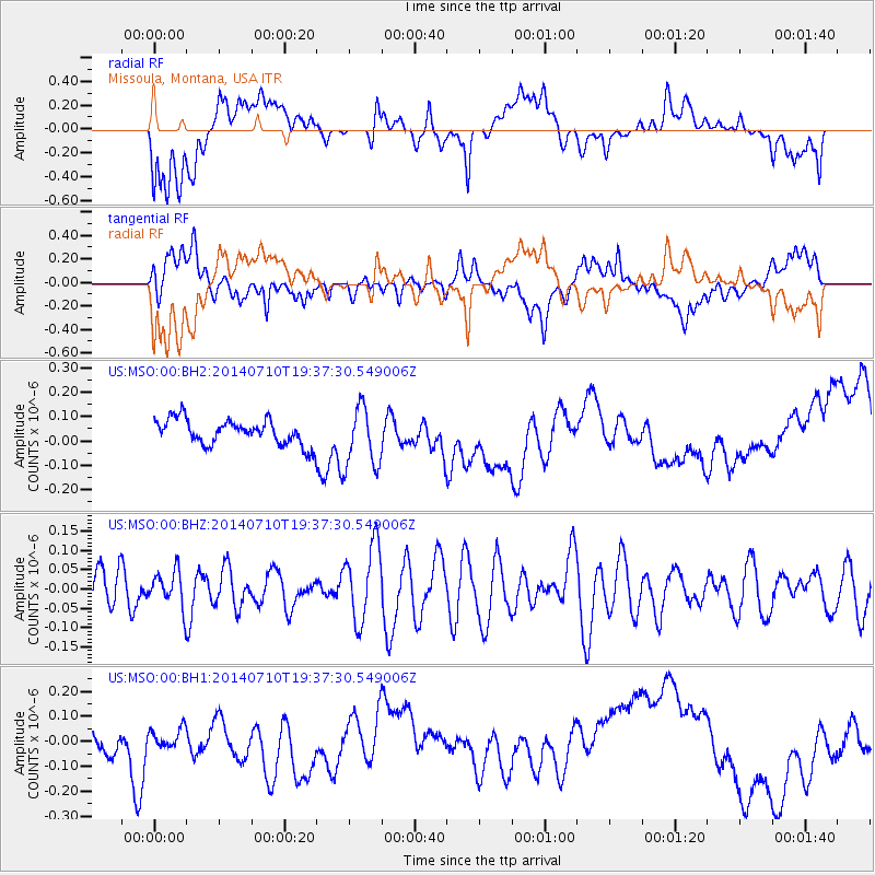
MSO Missoula, Montana, USA - Earthquake Result Viewer
*The percent match for this event was below the threshold and hence no stack was calculated.
| Earthquake location: |
Solomon Islands |
| Earthquake latitude/longitude: |
-7.4/156.2 |
| Earthquake time(UTC): |
2014/07/10 (191) 19:24:44 GMT |
| Earthquake Depth: |
54 km |
| Earthquake Magnitude: |
5.0 MW, 5.1 mb |
| Earthquake Catalog/Contributor: |
ISC/ISC |
|
| Network: |
US United States National Seismic Network |
| Station: |
MSO Missoula, Montana, USA |
| Lat/Lon: |
46.83 N/113.94 W |
| Elevation: |
1264 m |
|
| Distance: |
95.2 deg |
| Az: |
43.589 deg |
| Baz: |
264.863 deg |
| Ray Param: |
$rayparam |
*The percent match for this event was below the threshold and hence was not used in the summary stack. |
|
| Radial Match: |
21.566193 % |
| Radial Bump: |
400 |
| Transverse Match: |
21.82635 % |
| Transverse Bump: |
400 |
| SOD ConfigId: |
3390531 |
| Insert Time: |
2019-04-12 19:09:55.323 +0000 |
| GWidth: |
2.5 |
| Max Bumps: |
400 |
| Tol: |
0.001 |
|
Signal To Noise
| Channel | StoN | STA | LTA |
| US:MSO:00:BHZ:20140710T19:37:30.549006Z | 0.70328045 | 4.8568317E-8 | 6.905967E-8 |
| US:MSO:00:BH1:20140710T19:37:30.549006Z | 0.59818846 | 4.3856005E-8 | 7.3314695E-8 |
| US:MSO:00:BH2:20140710T19:37:30.549006Z | 2.439589 | 1.2441787E-7 | 5.099952E-8 |
| Arrivals |
| Ps | |
| PpPs | |
| PsPs/PpSs | |


