You are here: Home > Network List > TA - USArray Transportable Network (new EarthScope stations) Stations List
> Station X43A Marvell, AR, USA > Earthquake Result Viewer
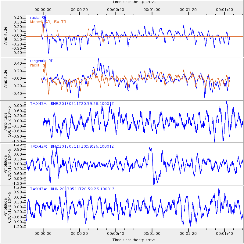
X43A Marvell, AR, USA - Earthquake Result Viewer
*The percent match for this event was below the threshold and hence no stack was calculated.
| Earthquake location: |
Tonga Islands |
| Earthquake latitude/longitude: |
-18.0/-175.1 |
| Earthquake time(UTC): |
2013/05/11 (131) 20:46:57 GMT |
| Earthquake Depth: |
213 km |
| Earthquake Magnitude: |
5.8 MB, 6.4 MW, 6.4 MW |
| Earthquake Catalog/Contributor: |
WHDF/NEIC |
|
| Network: |
TA USArray Transportable Network (new EarthScope stations) |
| Station: |
X43A Marvell, AR, USA |
| Lat/Lon: |
34.52 N/90.88 W |
| Elevation: |
53 m |
|
| Distance: |
95.4 deg |
| Az: |
55.606 deg |
| Baz: |
252.03 deg |
| Ray Param: |
$rayparam |
*The percent match for this event was below the threshold and hence was not used in the summary stack. |
|
| Radial Match: |
56.0145 % |
| Radial Bump: |
400 |
| Transverse Match: |
60.129314 % |
| Transverse Bump: |
400 |
| SOD ConfigId: |
508211 |
| Insert Time: |
2013-07-12 09:04:35.549 +0000 |
| GWidth: |
2.5 |
| Max Bumps: |
400 |
| Tol: |
0.001 |
|
Signal To Noise
| Channel | StoN | STA | LTA |
| TA:X43A: :BHZ:20130511T20:59:26.10001Z | 2.5926368 | 4.216027E-7 | 1.626154E-7 |
| TA:X43A: :BHN:20130511T20:59:26.10001Z | 0.6607308 | 2.07326E-7 | 3.1378286E-7 |
| TA:X43A: :BHE:20130511T20:59:26.10001Z | 1.668714 | 5.6542467E-7 | 3.3883856E-7 |
| Arrivals |
| Ps | |
| PpPs | |
| PsPs/PpSs | |


