You are here: Home > Network List > TA - USArray Transportable Network (new EarthScope stations) Stations List
> Station S44A Carbondale, IL, USA > Earthquake Result Viewer
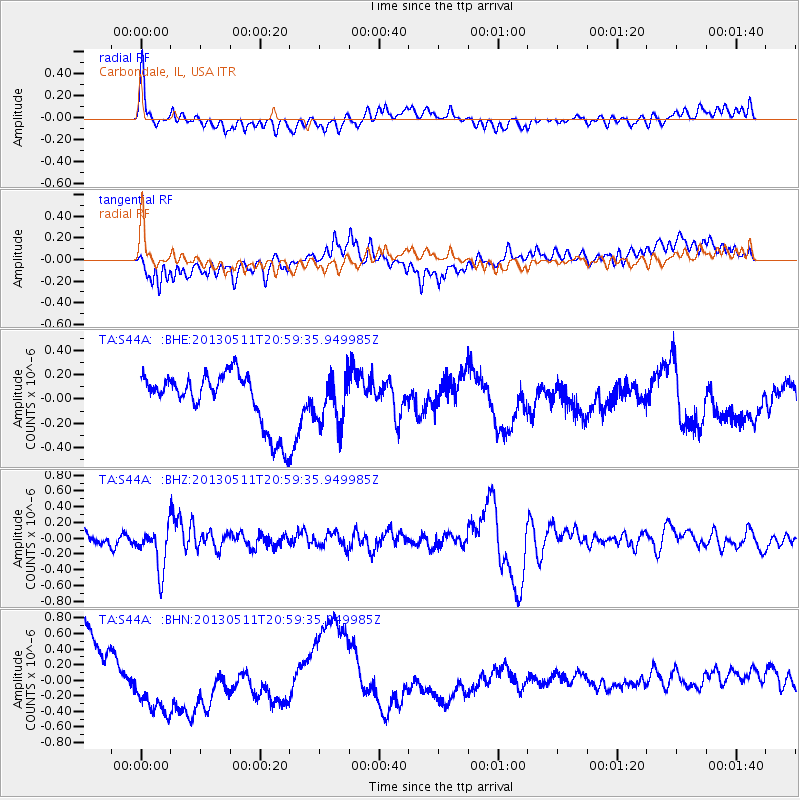
S44A Carbondale, IL, USA - Earthquake Result Viewer
*The percent match for this event was below the threshold and hence no stack was calculated.
| Earthquake location: |
Tonga Islands |
| Earthquake latitude/longitude: |
-18.0/-175.1 |
| Earthquake time(UTC): |
2013/05/11 (131) 20:46:57 GMT |
| Earthquake Depth: |
213 km |
| Earthquake Magnitude: |
5.8 MB, 6.4 MW, 6.4 MW |
| Earthquake Catalog/Contributor: |
WHDF/NEIC |
|
| Network: |
TA USArray Transportable Network (new EarthScope stations) |
| Station: |
S44A Carbondale, IL, USA |
| Lat/Lon: |
37.69 N/89.26 W |
| Elevation: |
155 m |
|
| Distance: |
97.6 deg |
| Az: |
52.957 deg |
| Baz: |
253.284 deg |
| Ray Param: |
$rayparam |
*The percent match for this event was below the threshold and hence was not used in the summary stack. |
|
| Radial Match: |
46.035736 % |
| Radial Bump: |
400 |
| Transverse Match: |
15.67221 % |
| Transverse Bump: |
400 |
| SOD ConfigId: |
508211 |
| Insert Time: |
2013-07-12 09:04:39.866 +0000 |
| GWidth: |
2.5 |
| Max Bumps: |
400 |
| Tol: |
0.001 |
|
Signal To Noise
| Channel | StoN | STA | LTA |
| TA:S44A: :BHZ:20130511T20:59:35.949985Z | 3.7451348 | 2.784071E-7 | 7.433834E-8 |
| TA:S44A: :BHN:20130511T20:59:35.949985Z | 1.3678632 | 4.368249E-7 | 3.1934837E-7 |
| TA:S44A: :BHE:20130511T20:59:35.949985Z | 0.889151 | 1.9310824E-7 | 2.1718274E-7 |
| Arrivals |
| Ps | |
| PpPs | |
| PsPs/PpSs | |


