You are here: Home > Network List > TA - USArray Transportable Network (new EarthScope stations) Stations List
> Station L39A Vinton, IA, USA > Earthquake Result Viewer
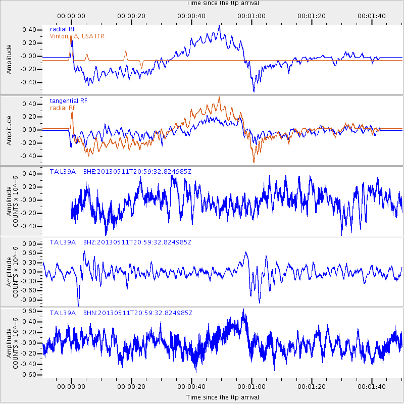
L39A Vinton, IA, USA - Earthquake Result Viewer
*The percent match for this event was below the threshold and hence no stack was calculated.
| Earthquake location: |
Tonga Islands |
| Earthquake latitude/longitude: |
-18.0/-175.1 |
| Earthquake time(UTC): |
2013/05/11 (131) 20:46:57 GMT |
| Earthquake Depth: |
213 km |
| Earthquake Magnitude: |
5.8 MB, 6.4 MW, 6.4 MW |
| Earthquake Catalog/Contributor: |
WHDF/NEIC |
|
| Network: |
TA USArray Transportable Network (new EarthScope stations) |
| Station: |
L39A Vinton, IA, USA |
| Lat/Lon: |
42.12 N/92.00 W |
| Elevation: |
261 m |
|
| Distance: |
96.9 deg |
| Az: |
48.067 deg |
| Baz: |
252.144 deg |
| Ray Param: |
$rayparam |
*The percent match for this event was below the threshold and hence was not used in the summary stack. |
|
| Radial Match: |
52.84016 % |
| Radial Bump: |
400 |
| Transverse Match: |
38.619274 % |
| Transverse Bump: |
400 |
| SOD ConfigId: |
508211 |
| Insert Time: |
2013-07-12 09:04:56.543 +0000 |
| GWidth: |
2.5 |
| Max Bumps: |
400 |
| Tol: |
0.001 |
|
Signal To Noise
| Channel | StoN | STA | LTA |
| TA:L39A: :BHZ:20130511T20:59:32.824985Z | 3.5097463 | 4.0452986E-7 | 1.15259006E-7 |
| TA:L39A: :BHN:20130511T20:59:32.824985Z | 1.3971229 | 2.0418854E-7 | 1.461493E-7 |
| TA:L39A: :BHE:20130511T20:59:32.824985Z | 1.5221158 | 2.5279985E-7 | 1.660845E-7 |
| Arrivals |
| Ps | |
| PpPs | |
| PsPs/PpSs | |


