You are here: Home > Network List > TA - USArray Transportable Network (new EarthScope stations) Stations List
> Station U41A Viola, AR, USA > Earthquake Result Viewer
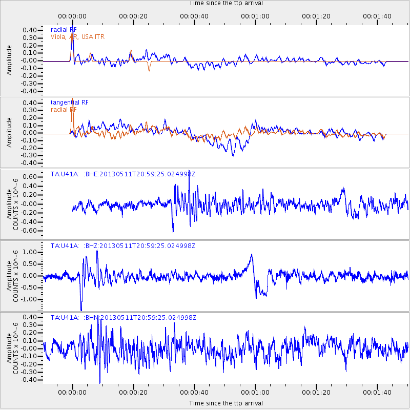
U41A Viola, AR, USA - Earthquake Result Viewer
*The percent match for this event was below the threshold and hence no stack was calculated.
| Earthquake location: |
Tonga Islands |
| Earthquake latitude/longitude: |
-18.0/-175.1 |
| Earthquake time(UTC): |
2013/05/11 (131) 20:46:57 GMT |
| Earthquake Depth: |
213 km |
| Earthquake Magnitude: |
5.8 MB, 6.4 MW, 6.4 MW |
| Earthquake Catalog/Contributor: |
WHDF/NEIC |
|
| Network: |
TA USArray Transportable Network (new EarthScope stations) |
| Station: |
U41A Viola, AR, USA |
| Lat/Lon: |
36.34 N/91.92 W |
| Elevation: |
300 m |
|
| Distance: |
95.1 deg |
| Az: |
53.602 deg |
| Baz: |
251.614 deg |
| Ray Param: |
$rayparam |
*The percent match for this event was below the threshold and hence was not used in the summary stack. |
|
| Radial Match: |
73.43515 % |
| Radial Bump: |
400 |
| Transverse Match: |
63.801445 % |
| Transverse Bump: |
400 |
| SOD ConfigId: |
508211 |
| Insert Time: |
2013-07-12 09:05:12.009 +0000 |
| GWidth: |
2.5 |
| Max Bumps: |
400 |
| Tol: |
0.001 |
|
Signal To Noise
| Channel | StoN | STA | LTA |
| TA:U41A: :BHZ:20130511T20:59:25.024998Z | 5.8867793 | 5.121349E-7 | 8.699747E-8 |
| TA:U41A: :BHN:20130511T20:59:25.024998Z | 1.6998818 | 1.0811616E-7 | 6.3602165E-8 |
| TA:U41A: :BHE:20130511T20:59:25.024998Z | 3.0923123 | 2.1465779E-7 | 6.941659E-8 |
| Arrivals |
| Ps | |
| PpPs | |
| PsPs/PpSs | |


