You are here: Home > Network List > TA - USArray Transportable Network (new EarthScope stations) Stations List
> Station H38A Maiden Rock, WI, USA > Earthquake Result Viewer
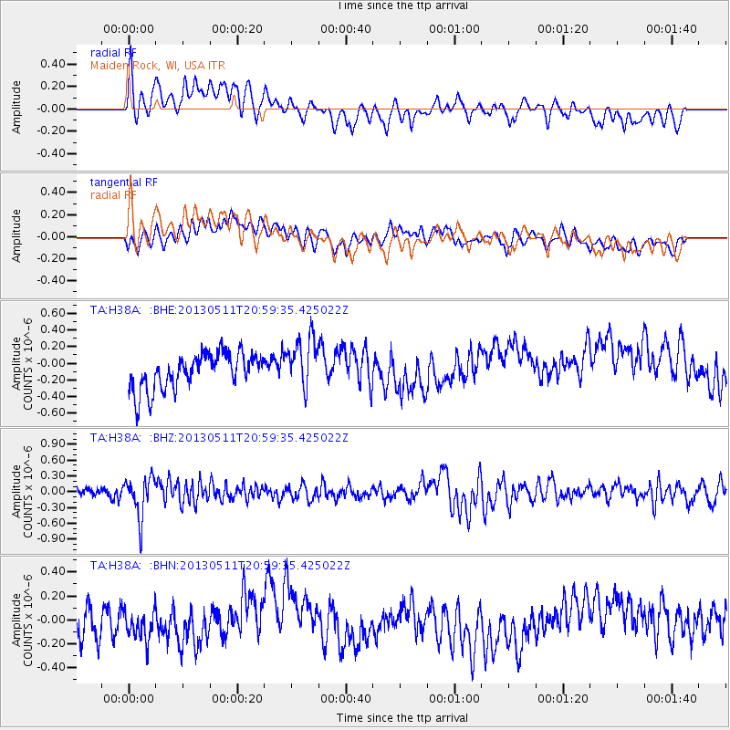
H38A Maiden Rock, WI, USA - Earthquake Result Viewer
*The percent match for this event was below the threshold and hence no stack was calculated.
| Earthquake location: |
Tonga Islands |
| Earthquake latitude/longitude: |
-18.0/-175.1 |
| Earthquake time(UTC): |
2013/05/11 (131) 20:46:57 GMT |
| Earthquake Depth: |
213 km |
| Earthquake Magnitude: |
5.8 MB, 6.4 MW, 6.4 MW |
| Earthquake Catalog/Contributor: |
WHDF/NEIC |
|
| Network: |
TA USArray Transportable Network (new EarthScope stations) |
| Station: |
H38A Maiden Rock, WI, USA |
| Lat/Lon: |
44.68 N/92.28 W |
| Elevation: |
333 m |
|
| Distance: |
97.5 deg |
| Az: |
45.556 deg |
| Baz: |
252.265 deg |
| Ray Param: |
$rayparam |
*The percent match for this event was below the threshold and hence was not used in the summary stack. |
|
| Radial Match: |
46.938114 % |
| Radial Bump: |
400 |
| Transverse Match: |
26.525848 % |
| Transverse Bump: |
400 |
| SOD ConfigId: |
508211 |
| Insert Time: |
2013-07-12 09:05:27.992 +0000 |
| GWidth: |
2.5 |
| Max Bumps: |
400 |
| Tol: |
0.001 |
|
Signal To Noise
| Channel | StoN | STA | LTA |
| TA:H38A: :BHZ:20130511T20:59:35.425022Z | 3.539938 | 3.8655182E-7 | 1.0919734E-7 |
| TA:H38A: :BHN:20130511T20:59:35.425022Z | 0.9130236 | 1.4960258E-7 | 1.6385403E-7 |
| TA:H38A: :BHE:20130511T20:59:35.425022Z | 1.4537059 | 3.1277614E-7 | 2.1515778E-7 |
| Arrivals |
| Ps | |
| PpPs | |
| PsPs/PpSs | |


