You are here: Home > Network List > GT - Global Telemetered Seismograph Network (USAF/USGS) Stations List
> Station LBTB Lobatse, Botswana, Africa > Earthquake Result Viewer
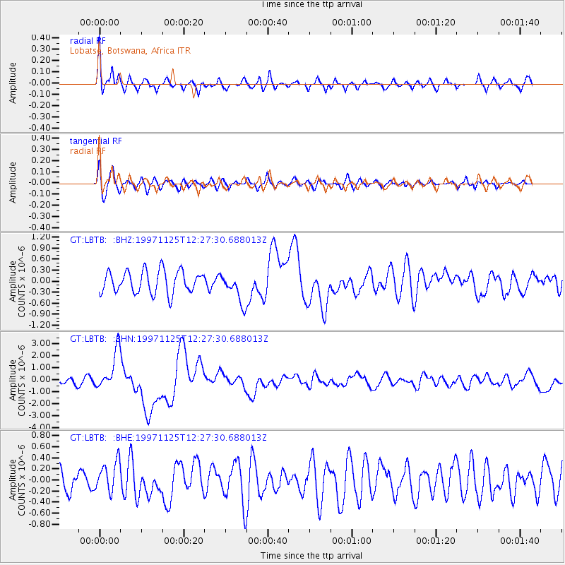
LBTB Lobatse, Botswana, Africa - Earthquake Result Viewer
*The percent match for this event was below the threshold and hence no stack was calculated.
| Earthquake location: |
Minahassa Peninsula, Sulawesi |
| Earthquake latitude/longitude: |
1.2/122.5 |
| Earthquake time(UTC): |
1997/11/25 (329) 12:14:33 GMT |
| Earthquake Depth: |
24 km |
| Earthquake Magnitude: |
6.1 MB, 6.8 MS, 7.1 UNKNOWN, 6.7 ME |
| Earthquake Catalog/Contributor: |
WHDF/NEIC |
|
| Network: |
GT Global Telemetered Seismograph Network (USAF/USGS) |
| Station: |
LBTB Lobatse, Botswana, Africa |
| Lat/Lon: |
25.02 S/25.60 E |
| Elevation: |
1128 m |
|
| Distance: |
96.8 deg |
| Az: |
245.099 deg |
| Baz: |
91.805 deg |
| Ray Param: |
$rayparam |
*The percent match for this event was below the threshold and hence was not used in the summary stack. |
|
| Radial Match: |
77.33995 % |
| Radial Bump: |
400 |
| Transverse Match: |
63.82634 % |
| Transverse Bump: |
400 |
| SOD ConfigId: |
4480 |
| Insert Time: |
2010-02-27 02:09:02.964 +0000 |
| GWidth: |
2.5 |
| Max Bumps: |
400 |
| Tol: |
0.001 |
|
Signal To Noise
| Channel | StoN | STA | LTA |
| GT:LBTB: :BHN:19971125T12:27:30.688013Z | 3.4796317 | 1.7042353E-6 | 4.8977466E-7 |
| GT:LBTB: :BHE:19971125T12:27:30.688013Z | 1.0861483 | 2.8531161E-7 | 2.6268202E-7 |
| GT:LBTB: :BHZ:19971125T12:27:30.688013Z | 1.3829406 | 4.1940828E-7 | 3.032728E-7 |
| Arrivals |
| Ps | |
| PpPs | |
| PsPs/PpSs | |


