BFS Mt Baldy Forest Station - Earthquake Result Viewer
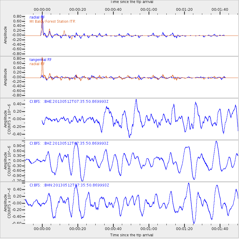
Earthquake location: Near Coast Of Guatemala
Earthquake latitude/longitude: 13.5/-91.4
Earthquake time(UTC): 2013/05/12 (132) 07:29:59 GMT
Earthquake Depth: 11 km
Earthquake Magnitude: 5.5 MS, 5.2 MB, 5.8 MW, 5.6 MW
Earthquake Catalog/Contributor: WHDF/NEIC
Network: CI Caltech Regional Seismic Network
Station: BFS Mt Baldy Forest Station
Lat/Lon: 34.24 N/117.66 W
Elevation: 1312 m
Distance: 31.5 deg
Az: 315.465 deg
Baz: 124.556 deg
Ray Param: 0.0790331
Estimated Moho Depth: 27.0 km
Estimated Crust Vp/Vs: 1.91
Assumed Crust Vp: 6.276 km/s
Estimated Crust Vs: 3.29 km/s
Estimated Crust Poisson's Ratio: 0.31
Radial Match: 90.11429 %
Radial Bump: 370
Transverse Match: 62.473427 %
Transverse Bump: 400
SOD ConfigId: 508211
Insert Time: 2013-07-12 09:20:18.848 +0000
GWidth: 2.5
Max Bumps: 400
Tol: 0.001

Signal To Noise

ChannelStoNSTALTA
CI:BFS: :BHZ:20130512T07:35:50.869993Z3.3274462.700745E-78.116571E-8
CI:BFS: :BHN:20130512T07:35:50.869993Z3.40376691.415175E-74.157673E-8
CI:BFS: :BHE:20130512T07:35:50.869993Z2.98550871.4077304E-74.7152113E-8
Arrivals
Ps4.2 SECOND
PpPs12 SECOND
PsPs/PpSs16 SECOND