You are here: Home > Network List > TA - USArray Transportable Network (new EarthScope stations) Stations List
> Station J49A Marlette, MI, USA > Earthquake Result Viewer
J49A Marlette, MI, USA - Earthquake Result Viewer
*The percent match for this event was below the threshold and hence no stack was calculated.
| Earthquake location: |
Near Coast Of Guatemala |
| Earthquake latitude/longitude: |
13.5/-91.4 |
| Earthquake time(UTC): |
2013/05/12 (132) 07:29:59 GMT |
| Earthquake Depth: |
11 km |
| Earthquake Magnitude: |
5.5 MS, 5.2 MB, 5.8 MW, 5.6 MW |
| Earthquake Catalog/Contributor: |
WHDF/NEIC |
|
| Network: |
TA USArray Transportable Network (new EarthScope stations) |
| Station: |
J49A Marlette, MI, USA |
| Lat/Lon: |
43.36 N/83.14 W |
| Elevation: |
253 m |
|
| Distance: |
30.6 deg |
| Az: |
11.841 deg |
| Baz: |
195.884 deg |
| Ray Param: |
$rayparam |
*The percent match for this event was below the threshold and hence was not used in the summary stack. |
|
| Radial Match: |
73.646065 % |
| Radial Bump: |
387 |
| Transverse Match: |
56.20781 % |
| Transverse Bump: |
400 |
| SOD ConfigId: |
508211 |
| Insert Time: |
2013-07-12 09:29:16.360 +0000 |
| GWidth: |
2.5 |
| Max Bumps: |
400 |
| Tol: |
0.001 |
|
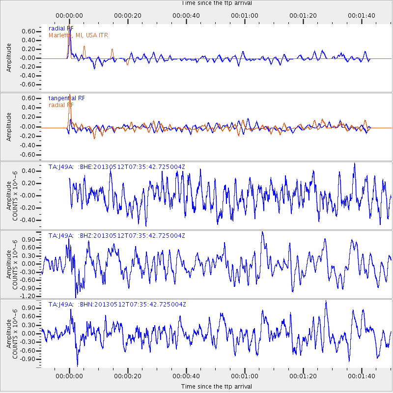
Signal To Noise
| Channel | StoN | STA | LTA |
| TA:J49A: :BHZ:20130512T07:35:42.725004Z | 3.1917455 | 6.4064955E-7 | 2.0072075E-7 |
| TA:J49A: :BHN:20130512T07:35:42.725004Z | 2.4190128 | 4.4664162E-7 | 1.8463797E-7 |
| TA:J49A: :BHE:20130512T07:35:42.725004Z | 0.9765775 | 1.6413318E-7 | 1.680698E-7 |
| Arrivals |
| Ps | |
| PpPs | |
| PsPs/PpSs | |


