You are here: Home > Network List > TA - USArray Transportable Network (new EarthScope stations) Stations List
> Station I48A Sherman Twp, MI, USA > Earthquake Result Viewer
I48A Sherman Twp, MI, USA - Earthquake Result Viewer

| Earthquake location: |
Near Coast Of Guatemala |
| Earthquake latitude/longitude: |
13.5/-91.4 |
| Earthquake time(UTC): |
2013/05/12 (132) 07:29:59 GMT |
| Earthquake Depth: |
11 km |
| Earthquake Magnitude: |
5.5 MS, 5.2 MB, 5.8 MW, 5.6 MW |
| Earthquake Catalog/Contributor: |
WHDF/NEIC |
|
| Network: |
TA USArray Transportable Network (new EarthScope stations) |
| Station: |
I48A Sherman Twp, MI, USA |
| Lat/Lon: |
44.19 N/83.70 W |
| Elevation: |
192 m |
|
| Distance: |
31.3 deg |
| Az: |
10.655 deg |
| Baz: |
194.478 deg |
| Ray Param: |
0.07910331 |
| Estimated Moho Depth: |
34.75 km |
| Estimated Crust Vp/Vs: |
1.97 |
| Assumed Crust Vp: |
6.483 km/s |
| Estimated Crust Vs: |
3.291 km/s |
| Estimated Crust Poisson's Ratio: |
0.33 |
|
| Radial Match: |
83.4299 % |
| Radial Bump: |
400 |
| Transverse Match: |
54.866703 % |
| Transverse Bump: |
400 |
| SOD ConfigId: |
508211 |
| Insert Time: |
2013-07-12 09:30:29.195 +0000 |
| GWidth: |
2.5 |
| Max Bumps: |
400 |
| Tol: |
0.001 |
|
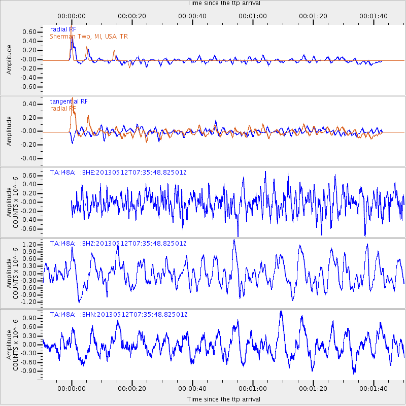
Signal To Noise
| Channel | StoN | STA | LTA |
| TA:I48A: :BHZ:20130512T07:35:48.82501Z | 2.675131 | 7.0220597E-7 | 2.6249404E-7 |
| TA:I48A: :BHN:20130512T07:35:48.82501Z | 2.3689783 | 4.2060356E-7 | 1.7754641E-7 |
| TA:I48A: :BHE:20130512T07:35:48.82501Z | 1.2716177 | 2.160722E-7 | 1.6991915E-7 |
| Arrivals |
| Ps | 5.6 SECOND |
| PpPs | 15 SECOND |
| PsPs/PpSs | 20 SECOND |


