LPAZ La Paz , Bolivia - Earthquake Result Viewer
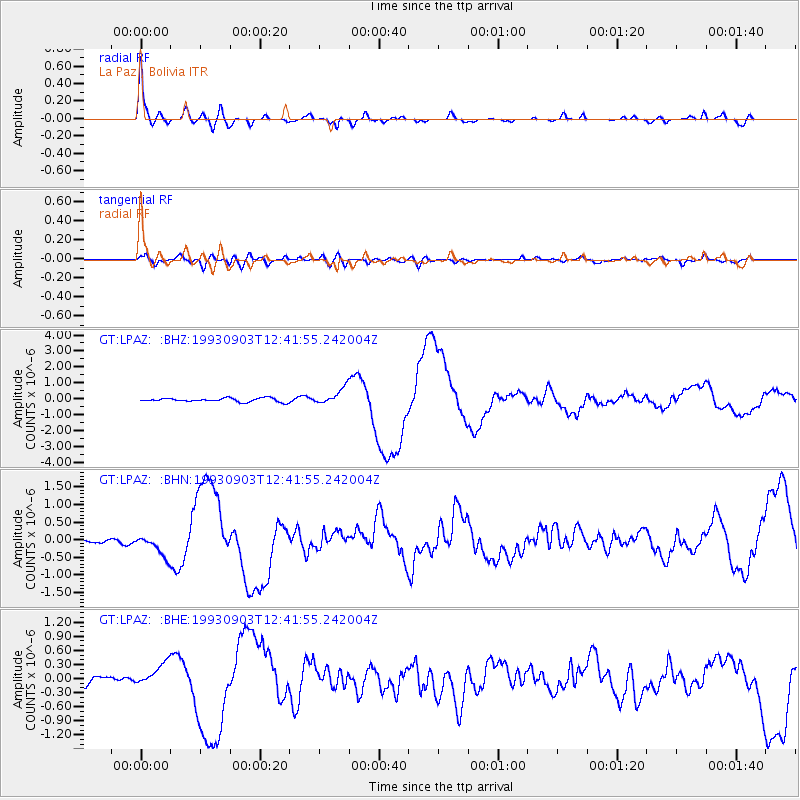
Earthquake location: Near Coast Of Chiapas, Mexico
Earthquake latitude/longitude: 14.6/-92.8
Earthquake time(UTC): 1993/09/03 (246) 12:35:01 GMT
Earthquake Depth: 33 km
Earthquake Magnitude: 5.8 MB, 6.8 MS, 6.8 UNKNOWN, 6.8 MW
Earthquake Catalog/Contributor: WHDF/NEIC
Network: GT Global Telemetered Seismograph Network (USAF/USGS)
Station: LPAZ La Paz , Bolivia
Lat/Lon: 16.29 S/68.13 W
Elevation: 4769 m
Distance: 39.2 deg
Az: 140.572 deg
Baz: 320.18 deg
Ray Param: 0.0750812
Estimated Moho Depth: 30.0 km
Estimated Crust Vp/Vs: 2.09
Assumed Crust Vp: 6.454 km/s
Estimated Crust Vs: 3.084 km/s
Estimated Crust Poisson's Ratio: 0.35
Radial Match: 92.722855 %
Radial Bump: 400
Transverse Match: 59.138603 %
Transverse Bump: 400
SOD ConfigId: 16938
Insert Time: 2010-02-27 02:09:29.383 +0000
GWidth: 2.5
Max Bumps: 400
Tol: 0.001

Signal To Noise

ChannelStoNSTALTA
GT:LPAZ: :BHN:19930903T12:41:55.242004Z4.5933183.0643864E-76.671401E-8
GT:LPAZ: :BHE:19930903T12:41:55.242004Z2.37749842.411902E-71.0144706E-7
GT:LPAZ: :BHZ:19930903T12:41:55.242004Z5.19564636.355278E-71.2231929E-7
Arrivals
Ps5.4 SECOND
PpPs14 SECOND
PsPs/PpSs19 SECOND