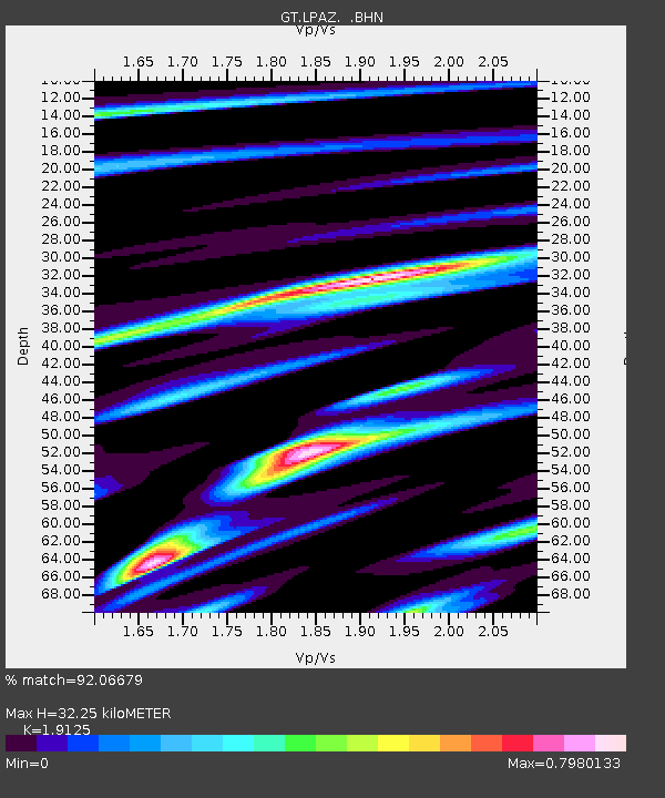
LPAZ La Paz , Bolivia - Earthquake Result Viewer
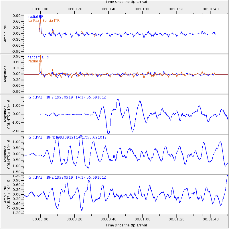
Earthquake location: Near Coast Of Chiapas, Mexico
Earthquake latitude/longitude: 14.6/-93.3
Earthquake time(UTC): 1993/09/19 (262) 14:10:59 GMT
Earthquake Depth: 33 km
Earthquake Magnitude: 5.8 MB, 6.3 MS, 6.2 UNKNOWN, 6.5 MW
Earthquake Catalog/Contributor: WHDF/NEIC
Network: GT Global Telemetered Seismograph Network (USAF/USGS)
Station: LPAZ La Paz , Bolivia
Lat/Lon: 16.29 S/68.13 W
Elevation: 4769 m
Distance: 39.5 deg
Az: 140.04 deg
Baz: 319.643 deg
Ray Param: 0.07491209
Estimated Moho Depth: 32.25 km
Estimated Crust Vp/Vs: 1.91
Assumed Crust Vp: 6.454 km/s
Estimated Crust Vs: 3.375 km/s
Estimated Crust Poisson's Ratio: 0.31
Radial Match: 92.06679 %
Radial Bump: 371
Transverse Match: 81.45349 %
Transverse Bump: 400
SOD ConfigId: 16938
Insert Time: 2010-02-27 02:09:31.425 +0000
GWidth: 2.5
Max Bumps: 400
Tol: 0.001

Signal To Noise

ChannelStoNSTALTA
GT:LPAZ: :BHN:19930919T14:17:55.69101Z2.11800121.7520021E-78.27196E-8
GT:LPAZ: :BHE:19930919T14:17:55.69101Z2.0643721.5415074E-77.467198E-8
GT:LPAZ: :BHZ:19930919T14:17:55.69101Z3.8989462.8301824E-77.25884E-8
Arrivals
Ps4.9 SECOND
PpPs14 SECOND
PsPs/PpSs18 SECOND