LPAZ La Paz , Bolivia - Earthquake Result Viewer
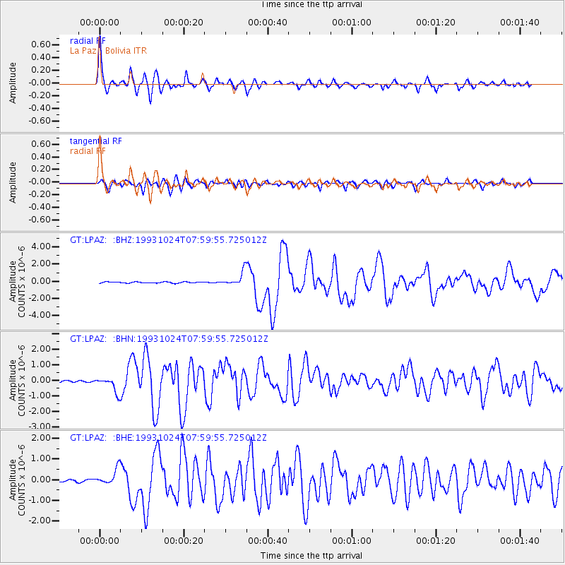
Earthquake location: Near Coast Of Guerrero, Mexico
Earthquake latitude/longitude: 16.8/-98.7
Earthquake time(UTC): 1993/10/24 (297) 07:52:17 GMT
Earthquake Depth: 32 km
Earthquake Magnitude: 6.2 MB, 6.6 MS, 6.5 UNKNOWN, 6.8 MW
Earthquake Catalog/Contributor: WHDF/NEIC
Network: GT Global Telemetered Seismograph Network (USAF/USGS)
Station: LPAZ La Paz , Bolivia
Lat/Lon: 16.29 S/68.13 W
Elevation: 4769 m
Distance: 44.6 deg
Az: 135.887 deg
Baz: 316.026 deg
Ray Param: 0.07175236
Estimated Moho Depth: 55.25 km
Estimated Crust Vp/Vs: 1.60
Assumed Crust Vp: 6.454 km/s
Estimated Crust Vs: 4.034 km/s
Estimated Crust Poisson's Ratio: 0.18
Radial Match: 92.38371 %
Radial Bump: 400
Transverse Match: 82.62099 %
Transverse Bump: 400
SOD ConfigId: 16938
Insert Time: 2010-02-27 02:09:33.444 +0000
GWidth: 2.5
Max Bumps: 400
Tol: 0.001

Signal To Noise

ChannelStoNSTALTA
GT:LPAZ: :BHN:19931024T07:59:55.725012Z11.7187215.100262E-74.352234E-8
GT:LPAZ: :BHE:19931024T07:59:55.725012Z8.7133474.023781E-74.6179508E-8
GT:LPAZ: :BHZ:19931024T07:59:55.725012Z15.7105461.033821E-66.580428E-8
Arrivals
Ps5.5 SECOND
PpPs21 SECOND
PsPs/PpSs26 SECOND