You are here: Home > Network List > TA - USArray Transportable Network (new EarthScope stations) Stations List
> Station R41A Rosebud, MO, USA > Earthquake Result Viewer
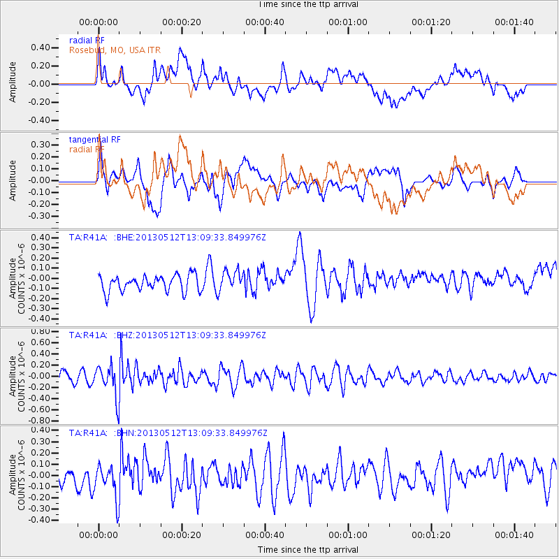
R41A Rosebud, MO, USA - Earthquake Result Viewer
*The percent match for this event was below the threshold and hence no stack was calculated.
| Earthquake location: |
Northern Chile |
| Earthquake latitude/longitude: |
-26.2/-69.4 |
| Earthquake time(UTC): |
2013/05/12 (132) 12:59:10 GMT |
| Earthquake Depth: |
10 km |
| Earthquake Magnitude: |
5.5 MB, 4.7 MS, 5.4 MW, 5.1 ML |
| Earthquake Catalog/Contributor: |
WHDF/NEIC |
|
| Network: |
TA USArray Transportable Network (new EarthScope stations) |
| Station: |
R41A Rosebud, MO, USA |
| Lat/Lon: |
38.30 N/91.38 W |
| Elevation: |
257 m |
|
| Distance: |
67.3 deg |
| Az: |
341.424 deg |
| Baz: |
158.662 deg |
| Ray Param: |
$rayparam |
*The percent match for this event was below the threshold and hence was not used in the summary stack. |
|
| Radial Match: |
41.863697 % |
| Radial Bump: |
400 |
| Transverse Match: |
53.693043 % |
| Transverse Bump: |
400 |
| SOD ConfigId: |
508211 |
| Insert Time: |
2013-07-12 09:42:00.301 +0000 |
| GWidth: |
2.5 |
| Max Bumps: |
400 |
| Tol: |
0.001 |
|
Signal To Noise
| Channel | StoN | STA | LTA |
| TA:R41A: :BHZ:20130512T13:09:33.849976Z | 3.2018914 | 2.8472388E-7 | 8.8923656E-8 |
| TA:R41A: :BHN:20130512T13:09:33.849976Z | 1.4087347 | 1.5660386E-7 | 1.1116634E-7 |
| TA:R41A: :BHE:20130512T13:09:33.849976Z | 1.241152 | 9.729751E-8 | 7.8392894E-8 |
| Arrivals |
| Ps | |
| PpPs | |
| PsPs/PpSs | |


