
LPAZ La Paz , Bolivia - Earthquake Result Viewer
| ||||||||||||||||||
| ||||||||||||||||||
| ||||||||||||||||||
|
Signal To Noise
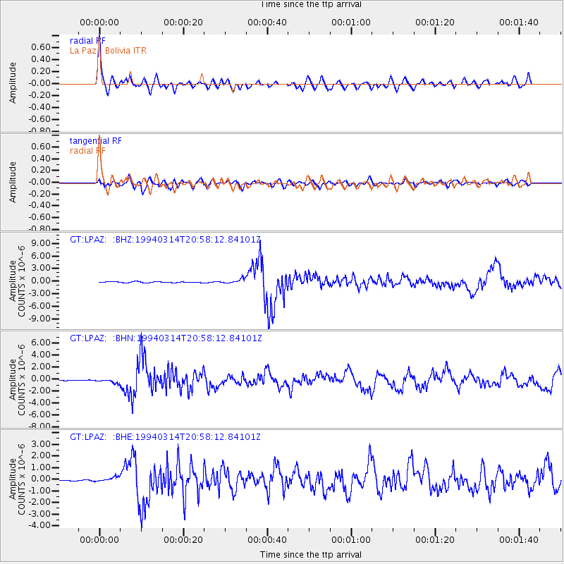
| Channel | StoN | STA | LTA |
| GT:LPAZ: :BHN:19940314T20:58:12.84101Z | 3.2801092 | 3.2781622E-7 | 9.994064E-8 |
| GT:LPAZ: :BHE:19940314T20:58:12.84101Z | 2.7951636 | 2.0036681E-7 | 7.168339E-8 |
| GT:LPAZ: :BHZ:19940314T20:58:12.84101Z | 6.057829 | 6.9622604E-7 | 1.1492996E-7 |
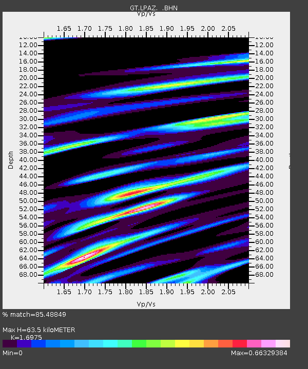
| Arrivals | |
| Ps | 7.4 SECOND |
| PpPs | 25 SECOND |
| PsPs/PpSs | 32 SECOND |

