You are here: Home > Network List > TA - USArray Transportable Network (new EarthScope stations) Stations List
> Station T46A Princeton, KY, USA > Earthquake Result Viewer
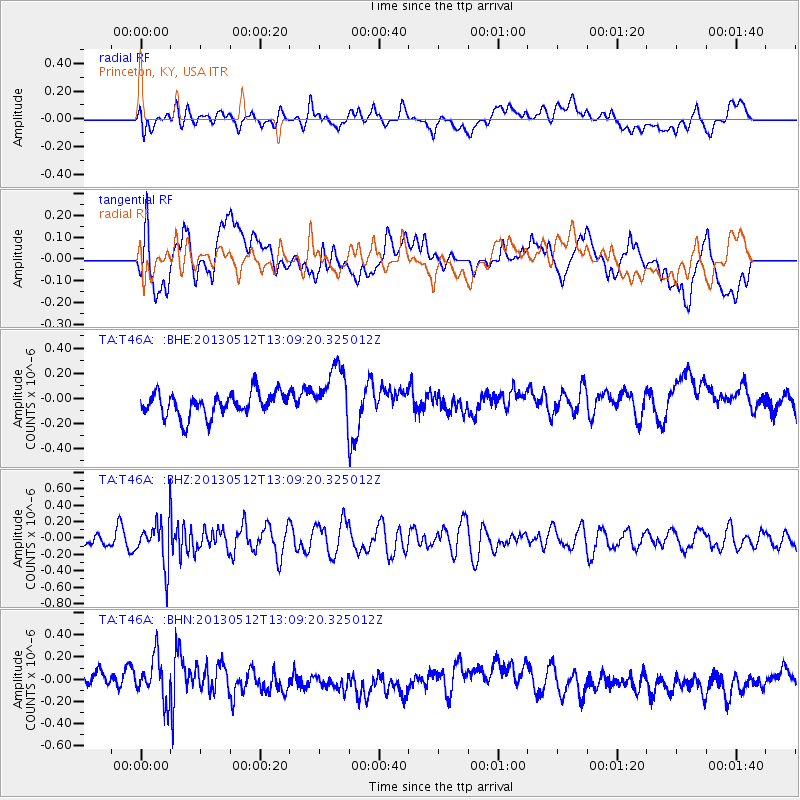
T46A Princeton, KY, USA - Earthquake Result Viewer
*The percent match for this event was below the threshold and hence no stack was calculated.
| Earthquake location: |
Northern Chile |
| Earthquake latitude/longitude: |
-26.2/-69.4 |
| Earthquake time(UTC): |
2013/05/12 (132) 12:59:10 GMT |
| Earthquake Depth: |
10 km |
| Earthquake Magnitude: |
5.5 MB, 4.7 MS, 5.4 MW, 5.1 ML |
| Earthquake Catalog/Contributor: |
WHDF/NEIC |
|
| Network: |
TA USArray Transportable Network (new EarthScope stations) |
| Station: |
T46A Princeton, KY, USA |
| Lat/Lon: |
37.04 N/87.89 W |
| Elevation: |
169 m |
|
| Distance: |
65.2 deg |
| Az: |
343.803 deg |
| Baz: |
161.741 deg |
| Ray Param: |
$rayparam |
*The percent match for this event was below the threshold and hence was not used in the summary stack. |
|
| Radial Match: |
37.388237 % |
| Radial Bump: |
400 |
| Transverse Match: |
41.703808 % |
| Transverse Bump: |
400 |
| SOD ConfigId: |
508211 |
| Insert Time: |
2013-07-12 09:43:24.394 +0000 |
| GWidth: |
2.5 |
| Max Bumps: |
400 |
| Tol: |
0.001 |
|
Signal To Noise
| Channel | StoN | STA | LTA |
| TA:T46A: :BHZ:20130512T13:09:20.325012Z | 2.4343467 | 2.6882478E-7 | 1.1042995E-7 |
| TA:T46A: :BHN:20130512T13:09:20.325012Z | 2.2358274 | 1.958389E-7 | 8.759123E-8 |
| TA:T46A: :BHE:20130512T13:09:20.325012Z | 2.3128464 | 2.208008E-7 | 9.546712E-8 |
| Arrivals |
| Ps | |
| PpPs | |
| PsPs/PpSs | |


