LPAZ La Paz , Bolivia - Earthquake Result Viewer
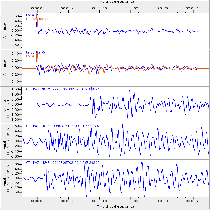
Earthquake location: Southern East Pacific Rise
Earthquake latitude/longitude: -21.5/-113.7
Earthquake time(UTC): 1994/03/06 (065) 08:01:43 GMT
Earthquake Depth: 10 km
Earthquake Magnitude: 5.5 MB, 5.6 MS, 5.8 UNKNOWN
Earthquake Catalog/Contributor: WHDF/NEIC
Network: GT Global Telemetered Seismograph Network (USAF/USGS)
Station: LPAZ La Paz , Bolivia
Lat/Lon: 16.29 S/68.13 W
Elevation: 4769 m
Distance: 43.3 deg
Az: 91.209 deg
Baz: 255.813 deg
Ray Param: 0.072662465
Estimated Moho Depth: 69.0 km
Estimated Crust Vp/Vs: 2.07
Assumed Crust Vp: 6.454 km/s
Estimated Crust Vs: 3.125 km/s
Estimated Crust Poisson's Ratio: 0.35
Radial Match: 87.711464 %
Radial Bump: 341
Transverse Match: 75.095085 %
Transverse Bump: 400
SOD ConfigId: 17000
Insert Time: 2010-02-27 02:09:41.767 +0000
GWidth: 2.5
Max Bumps: 400
Tol: 0.001

Signal To Noise

ChannelStoNSTALTA
GT:LPAZ: :BHN:19940306T08:09:14.638989Z0.83388927.6678894E-89.195334E-8
GT:LPAZ: :BHE:19940306T08:09:14.638989Z0.801299045.860382E-87.3136015E-8
GT:LPAZ: :BHZ:19940306T08:09:14.638989Z1.5255121.321717E-78.664088E-8
Arrivals
Ps12 SECOND
PpPs31 SECOND
PsPs/PpSs43 SECOND