You are here: Home > Network List > UW - Pacific Northwest Regional Seismic Network Stations List
> Station UMAT Pilot Rock, OR, USA > Earthquake Result Viewer
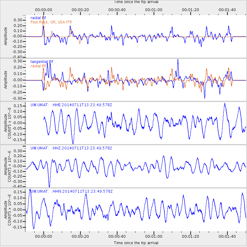
UMAT Pilot Rock, OR, USA - Earthquake Result Viewer
*The percent match for this event was below the threshold and hence no stack was calculated.
| Earthquake location: |
Northeast Of Taiwan |
| Earthquake latitude/longitude: |
26.3/125.8 |
| Earthquake time(UTC): |
2014/07/11 (192) 13:11:45 GMT |
| Earthquake Depth: |
116 km |
| Earthquake Magnitude: |
5.3 MW, 5.3 mb, 5.3 Mwb |
| Earthquake Catalog/Contributor: |
ISC/ISC |
|
| Network: |
UW Pacific Northwest Regional Seismic Network |
| Station: |
UMAT Pilot Rock, OR, USA |
| Lat/Lon: |
45.29 N/118.96 W |
| Elevation: |
1318 m |
|
| Distance: |
87.6 deg |
| Az: |
39.734 deg |
| Baz: |
305.63 deg |
| Ray Param: |
$rayparam |
*The percent match for this event was below the threshold and hence was not used in the summary stack. |
|
| Radial Match: |
53.615875 % |
| Radial Bump: |
400 |
| Transverse Match: |
57.58772 % |
| Transverse Bump: |
343 |
| SOD ConfigId: |
3390531 |
| Insert Time: |
2019-04-12 19:27:52.305 +0000 |
| GWidth: |
2.5 |
| Max Bumps: |
400 |
| Tol: |
0.001 |
|
Signal To Noise
| Channel | StoN | STA | LTA |
| UW:UMAT: :HHZ:20140711T13:23:49.578Z | 2.2022178 | 1.5643812E-7 | 7.103663E-8 |
| UW:UMAT: :HHN:20140711T13:23:49.578Z | 0.7748209 | 7.680594E-8 | 9.912734E-8 |
| UW:UMAT: :HHE:20140711T13:23:49.578Z | 0.8207677 | 5.986012E-8 | 7.293187E-8 |
| Arrivals |
| Ps | |
| PpPs | |
| PsPs/PpSs | |


