
LPAZ La Paz , Bolivia - Earthquake Result Viewer
| ||||||||||||||||||
| ||||||||||||||||||
| ||||||||||||||||||
|
Signal To Noise
| Channel | StoN | STA | LTA |
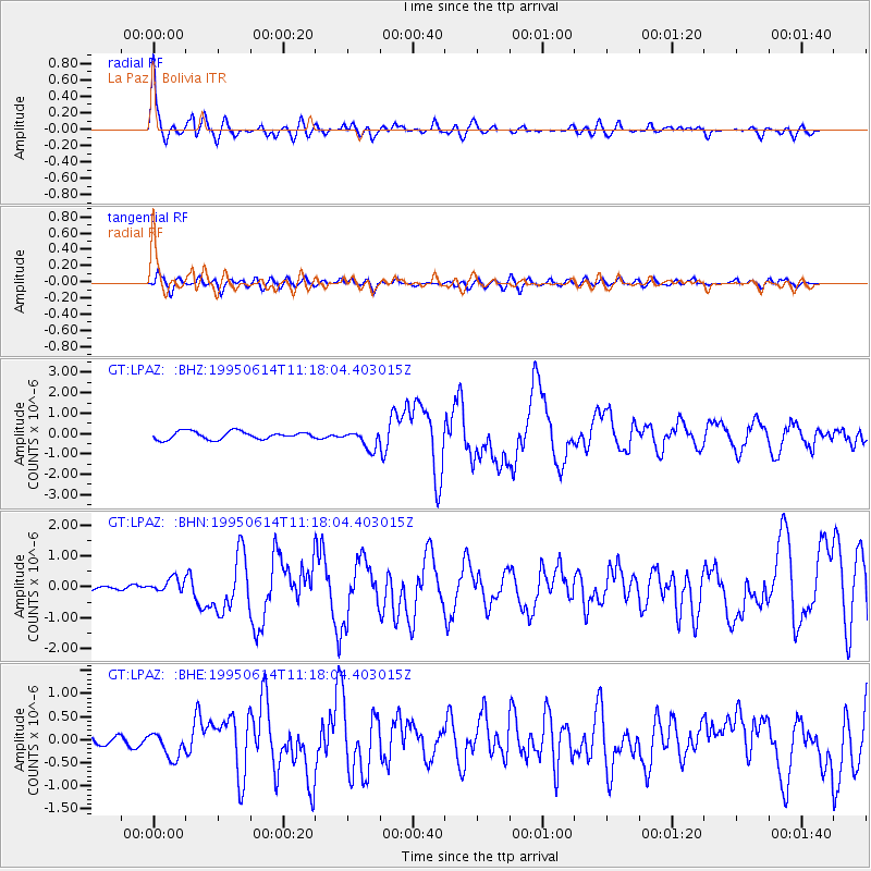
| GT:LPAZ: :BHN:19950614T11:18:04.403015Z | 3.0793872 | 2.3678075E-7 | 7.6892164E-8 |
| GT:LPAZ: :BHE:19950614T11:18:04.403015Z | 2.9663966 | 2.826962E-7 | 9.529953E-8 |
| GT:LPAZ: :BHZ:19950614T11:18:04.403015Z | 2.753243 | 5.299103E-7 | 1.9246768E-7 |
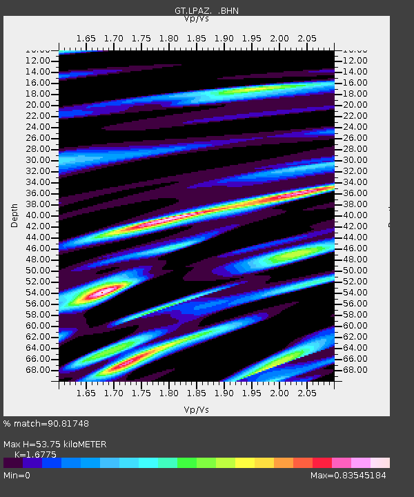
| Arrivals | |
| Ps | 6.1 SECOND |
| PpPs | 21 SECOND |
| PsPs/PpSs | 27 SECOND |

