LPAZ La Paz , Bolivia - Earthquake Result Viewer
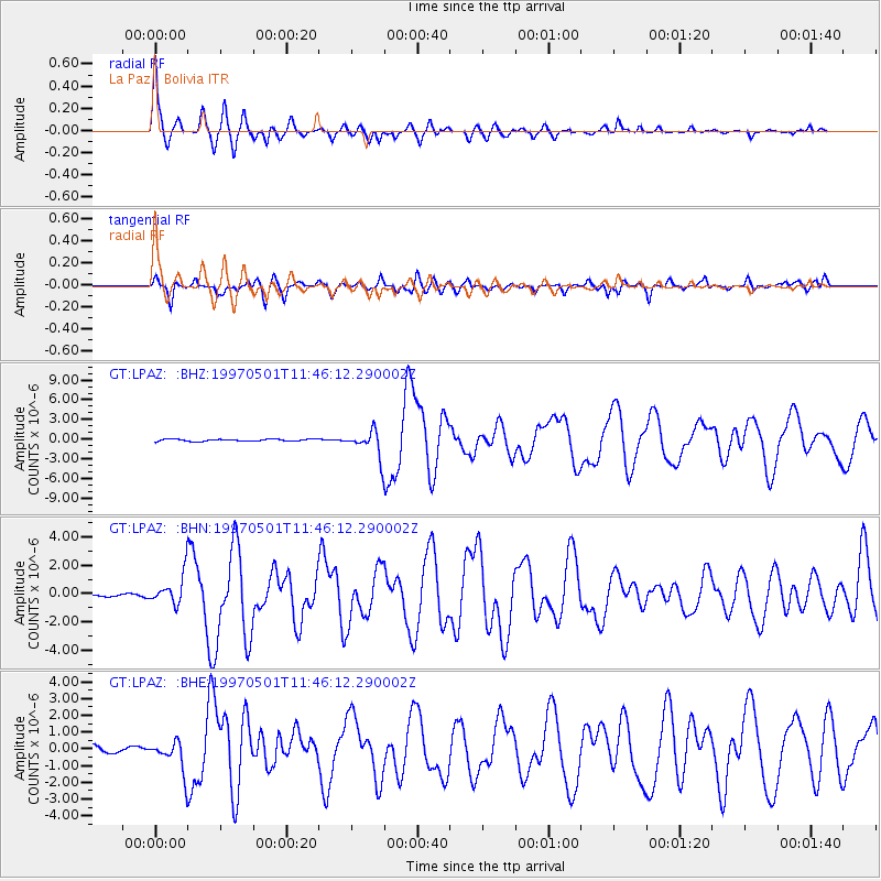
Earthquake location: Off Coast Of Jalisco, Mexico
Earthquake latitude/longitude: 19.0/-107.3
Earthquake time(UTC): 1997/05/01 (121) 11:37:36 GMT
Earthquake Depth: 33 km
Earthquake Magnitude: 6.1 MB, 6.8 MS, 7.1 UNKNOWN, 7.1 ME
Earthquake Catalog/Contributor: WHDF/NEIC
Network: GT Global Telemetered Seismograph Network (USAF/USGS)
Station: LPAZ La Paz , Bolivia
Lat/Lon: 16.29 S/68.13 W
Elevation: 4769 m
Distance: 52.1 deg
Az: 129.717 deg
Baz: 310.722 deg
Ray Param: 0.06689462
Estimated Moho Depth: 35.75 km
Estimated Crust Vp/Vs: 1.60
Assumed Crust Vp: 6.454 km/s
Estimated Crust Vs: 4.027 km/s
Estimated Crust Poisson's Ratio: 0.18
Radial Match: 96.23072 %
Radial Bump: 370
Transverse Match: 88.76293 %
Transverse Bump: 400
SOD ConfigId: 6273
Insert Time: 2010-02-27 02:10:00.500 +0000
GWidth: 2.5
Max Bumps: 400
Tol: 0.001

Signal To Noise

ChannelStoNSTALTA
GT:LPAZ: :BHN:19970501T11:46:12.290002Z10.4092251.1060887E-61.0626042E-7
GT:LPAZ: :BHE:19970501T11:46:12.290002Z6.3600249.697834E-71.5248109E-7
GT:LPAZ: :BHZ:19970501T11:46:12.290002Z16.988672.6774612E-61.5760274E-7
Arrivals
Ps3.6 SECOND
PpPs14 SECOND
PsPs/PpSs17 SECOND