You are here: Home > Network List > GS - US Geological Survey Networks Stations List
> Station KAN10 Keim Farm > Earthquake Result Viewer
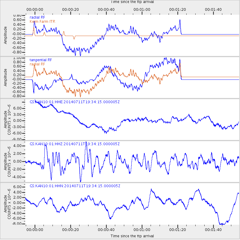
KAN10 Keim Farm - Earthquake Result Viewer
*The percent match for this event was below the threshold and hence no stack was calculated.
| Earthquake location: |
Off East Coast Of Honshu, Japan |
| Earthquake latitude/longitude: |
37.1/142.4 |
| Earthquake time(UTC): |
2014/07/11 (192) 19:22:00 GMT |
| Earthquake Depth: |
13 km |
| Earthquake Magnitude: |
6.8 MWP, 6.8 MI |
| Earthquake Catalog/Contributor: |
NEIC PDE/NEIC COMCAT |
|
| Network: |
GS US Geological Survey Networks |
| Station: |
KAN10 Keim Farm |
| Lat/Lon: |
37.12 N/98.10 W |
| Elevation: |
417 m |
|
| Distance: |
87.4 deg |
| Az: |
44.115 deg |
| Baz: |
315.846 deg |
| Ray Param: |
$rayparam |
*The percent match for this event was below the threshold and hence was not used in the summary stack. |
|
| Radial Match: |
36.00215 % |
| Radial Bump: |
400 |
| Transverse Match: |
41.033844 % |
| Transverse Bump: |
400 |
| SOD ConfigId: |
3390531 |
| Insert Time: |
2019-04-12 19:31:59.152 +0000 |
| GWidth: |
2.5 |
| Max Bumps: |
400 |
| Tol: |
0.001 |
|
Signal To Noise
| Channel | StoN | STA | LTA |
| GS:KAN10:01:HHZ:20140711T19:34:15.000005Z | 2.9784286 | 8.396321E-7 | 2.819044E-7 |
| GS:KAN10:01:HHN:20140711T19:34:15.000005Z | 0.34535426 | 1.0135736E-6 | 2.934881E-6 |
| GS:KAN10:01:HHE:20140711T19:34:15.000005Z | 3.0014038 | 7.4478316E-6 | 2.4814494E-6 |
| Arrivals |
| Ps | |
| PpPs | |
| PsPs/PpSs | |


