LPAZ La Paz , Bolivia - Earthquake Result Viewer
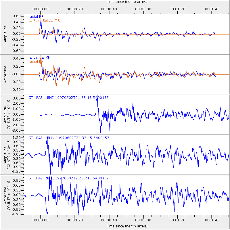
Earthquake location: South Sandwich Islands Region
Earthquake latitude/longitude: -57.8/-25.5
Earthquake time(UTC): 1997/06/02 (153) 21:24:38 GMT
Earthquake Depth: 33 km
Earthquake Magnitude: 5.9 MB, 5.8 MS, 6.1 UNKNOWN, 6.1 MW
Earthquake Catalog/Contributor: WHDF/NEIC
Network: GT Global Telemetered Seismograph Network (USAF/USGS)
Station: LPAZ La Paz , Bolivia
Lat/Lon: 16.29 S/68.13 W
Elevation: 4769 m
Distance: 52.1 deg
Az: 304.477 deg
Baz: 152.619 deg
Ray Param: 0.06688869
Estimated Moho Depth: 27.0 km
Estimated Crust Vp/Vs: 1.63
Assumed Crust Vp: 6.454 km/s
Estimated Crust Vs: 3.959 km/s
Estimated Crust Poisson's Ratio: 0.20
Radial Match: 83.71005 %
Radial Bump: 400
Transverse Match: 80.75253 %
Transverse Bump: 400
SOD ConfigId: 6273
Insert Time: 2010-02-27 02:10:07.433 +0000
GWidth: 2.5
Max Bumps: 400
Tol: 0.001

Signal To Noise

ChannelStoNSTALTA
GT:LPAZ: :BHN:19970602T21:33:15.540015Z6.10316754.6503473E-77.619564E-8
GT:LPAZ: :BHE:19970602T21:33:15.540015Z6.70195634.3841007E-76.541524E-8
GT:LPAZ: :BHZ:19970602T21:33:15.540015Z17.8896981.2547987E-67.014086E-8
Arrivals
Ps2.8 SECOND
PpPs10 SECOND
PsPs/PpSs13 SECOND