LPAZ La Paz , Bolivia - Earthquake Result Viewer
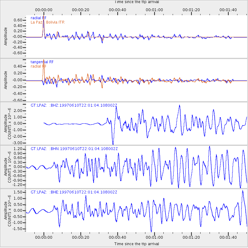
Earthquake location: Southern East Pacific Rise
Earthquake latitude/longitude: -35.8/-108.1
Earthquake time(UTC): 1997/06/10 (161) 21:53:55 GMT
Earthquake Depth: 10 km
Earthquake Magnitude: 5.8 MB, 6.1 MS, 6.5 UNKNOWN, 5.8 MS
Earthquake Catalog/Contributor: WHDF/NEIC
Network: GT Global Telemetered Seismograph Network (USAF/USGS)
Station: LPAZ La Paz , Bolivia
Lat/Lon: 16.29 S/68.13 W
Elevation: 4769 m
Distance: 40.5 deg
Az: 71.88 deg
Baz: 233.546 deg
Ray Param: 0.07435994
Estimated Moho Depth: 58.75 km
Estimated Crust Vp/Vs: 1.81
Assumed Crust Vp: 6.454 km/s
Estimated Crust Vs: 3.566 km/s
Estimated Crust Poisson's Ratio: 0.28
Radial Match: 85.026215 %
Radial Bump: 400
Transverse Match: 75.55281 %
Transverse Bump: 400
SOD ConfigId: 6273
Insert Time: 2010-02-27 02:10:08.598 +0000
GWidth: 2.5
Max Bumps: 400
Tol: 0.001

Signal To Noise

ChannelStoNSTALTA
GT:LPAZ: :BHN:19970610T22:01:04.108002Z1.64904327.6442134E-84.6355446E-8
GT:LPAZ: :BHE:19970610T22:01:04.108002Z0.83068998.792424E-81.0584484E-7
GT:LPAZ: :BHZ:19970610T22:01:04.108002Z1.8463421.1869768E-76.4288024E-8
Arrivals
Ps7.9 SECOND
PpPs24 SECOND
PsPs/PpSs32 SECOND