LPAZ La Paz , Bolivia - Earthquake Result Viewer
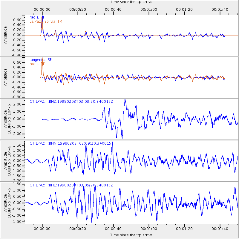
Earthquake location: Near Coast Of Oaxaca, Mexico
Earthquake latitude/longitude: 15.9/-96.3
Earthquake time(UTC): 1998/02/03 (034) 03:02:00 GMT
Earthquake Depth: 33 km
Earthquake Magnitude: 6.0 MB, 6.2 MS, 6.3 UNKNOWN, 6.4 MD
Earthquake Catalog/Contributor: WHDF/NEIC
Network: GT Global Telemetered Seismograph Network (USAF/USGS)
Station: LPAZ La Paz , Bolivia
Lat/Lon: 16.29 S/68.13 W
Elevation: 4769 m
Distance: 42.4 deg
Az: 137.716 deg
Baz: 317.611 deg
Ray Param: 0.07315778
Estimated Moho Depth: 63.5 km
Estimated Crust Vp/Vs: 1.71
Assumed Crust Vp: 6.454 km/s
Estimated Crust Vs: 3.78 km/s
Estimated Crust Poisson's Ratio: 0.24
Radial Match: 85.63108 %
Radial Bump: 336
Transverse Match: 74.24786 %
Transverse Bump: 400
SOD ConfigId: 6273
Insert Time: 2010-02-27 02:10:14.319 +0000
GWidth: 2.5
Max Bumps: 400
Tol: 0.001

Signal To Noise

ChannelStoNSTALTA
GT:LPAZ: :BHN:19980203T03:09:20.340015Z3.4118883.2671923E-79.575908E-8
GT:LPAZ: :BHE:19980203T03:09:20.340015Z2.86265952.3739226E-78.292718E-8
GT:LPAZ: :BHZ:19980203T03:09:20.340015Z8.1343376.247901E-77.680898E-8
Arrivals
Ps7.5 SECOND
PpPs25 SECOND
PsPs/PpSs32 SECOND