You are here: Home > Network List > TA - USArray Transportable Network (new EarthScope stations) Stations List
> Station T46A Princeton, KY, USA > Earthquake Result Viewer
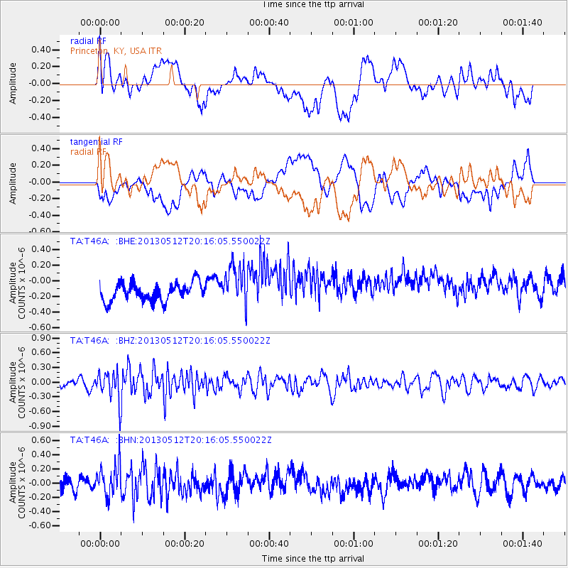
T46A Princeton, KY, USA - Earthquake Result Viewer
*The percent match for this event was below the threshold and hence no stack was calculated.
| Earthquake location: |
Fox Islands, Aleutian Islands |
| Earthquake latitude/longitude: |
52.5/-172.0 |
| Earthquake time(UTC): |
2013/05/12 (132) 20:06:41 GMT |
| Earthquake Depth: |
8.0 km |
| Earthquake Magnitude: |
5.7 MB, 5.1 MS, 5.4 MW, 5.3 MW |
| Earthquake Catalog/Contributor: |
WHDF/NEIC |
|
| Network: |
TA USArray Transportable Network (new EarthScope stations) |
| Station: |
T46A Princeton, KY, USA |
| Lat/Lon: |
37.04 N/87.89 W |
| Elevation: |
169 m |
|
| Distance: |
58.3 deg |
| Az: |
69.271 deg |
| Baz: |
314.389 deg |
| Ray Param: |
$rayparam |
*The percent match for this event was below the threshold and hence was not used in the summary stack. |
|
| Radial Match: |
22.493391 % |
| Radial Bump: |
400 |
| Transverse Match: |
21.070719 % |
| Transverse Bump: |
400 |
| SOD ConfigId: |
508211 |
| Insert Time: |
2013-07-12 10:11:52.801 +0000 |
| GWidth: |
2.5 |
| Max Bumps: |
400 |
| Tol: |
0.001 |
|
Signal To Noise
| Channel | StoN | STA | LTA |
| TA:T46A: :BHZ:20130512T20:16:05.550022Z | 2.5481002 | 2.9854232E-7 | 1.171627E-7 |
| TA:T46A: :BHN:20130512T20:16:05.550022Z | 2.0167148 | 2.2533243E-7 | 1.1173241E-7 |
| TA:T46A: :BHE:20130512T20:16:05.550022Z | 2.2978153 | 2.6680422E-7 | 1.16112126E-7 |
| Arrivals |
| Ps | |
| PpPs | |
| PsPs/PpSs | |


