LPAZ La Paz , Bolivia - Earthquake Result Viewer
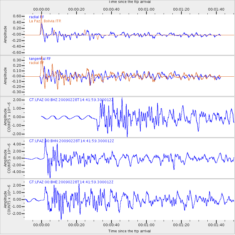
Earthquake location: South Sandwich Islands Region
Earthquake latitude/longitude: -60.5/-24.8
Earthquake time(UTC): 2009/02/28 (059) 14:33:06 GMT
Earthquake Depth: 15 km
Earthquake Magnitude: 6.1 MB, 6.1 MS, 6.3 MW, 6.3 MW
Earthquake Catalog/Contributor: WHDF/NEIC
Network: GT Global Telemetered Seismograph Network (USAF/USGS)
Station: LPAZ La Paz , Bolivia
Lat/Lon: 16.17 S/68.08 W
Elevation: 4817 m
Distance: 54.1 deg
Az: 305.568 deg
Baz: 155.251 deg
Ray Param: 0.065655105
Estimated Moho Depth: 61.75 km
Estimated Crust Vp/Vs: 1.62
Assumed Crust Vp: 6.454 km/s
Estimated Crust Vs: 3.99 km/s
Estimated Crust Poisson's Ratio: 0.19
Radial Match: 85.7623 %
Radial Bump: 400
Transverse Match: 75.121796 %
Transverse Bump: 400
SOD ConfigId: 2658
Insert Time: 2010-02-27 02:10:32.599 +0000
GWidth: 2.5
Max Bumps: 400
Tol: 0.001

Signal To Noise

ChannelStoNSTALTA
GT:LPAZ:00:BHN:20090228T14:41:59.300012Z24.4349162.3914745E-69.7871194E-8
GT:LPAZ:00:BHE:20090228T14:41:59.300012Z7.3622668.405176E-71.1416561E-7
GT:LPAZ:00:BHZ:20090228T14:41:59.300012Z6.22471678.524263E-71.3694218E-7
Arrivals
Ps6.3 SECOND
PpPs24 SECOND
PsPs/PpSs30 SECOND