You are here: Home > Network List > TA - USArray Transportable Network (new EarthScope stations) Stations List
> Station Z53A Monticello, GA, USA > Earthquake Result Viewer
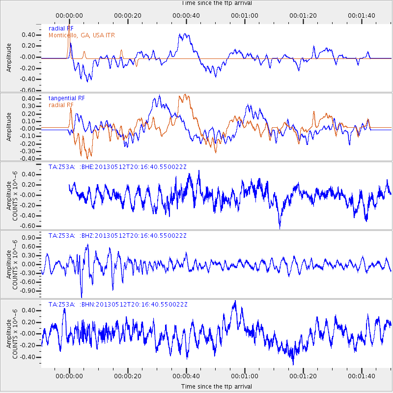
Z53A Monticello, GA, USA - Earthquake Result Viewer
*The percent match for this event was below the threshold and hence no stack was calculated.
| Earthquake location: |
Fox Islands, Aleutian Islands |
| Earthquake latitude/longitude: |
52.5/-172.0 |
| Earthquake time(UTC): |
2013/05/12 (132) 20:06:41 GMT |
| Earthquake Depth: |
8.0 km |
| Earthquake Magnitude: |
5.7 MB, 5.1 MS, 5.4 MW, 5.3 MW |
| Earthquake Catalog/Contributor: |
WHDF/NEIC |
|
| Network: |
TA USArray Transportable Network (new EarthScope stations) |
| Station: |
Z53A Monticello, GA, USA |
| Lat/Lon: |
33.28 N/83.57 W |
| Elevation: |
144 m |
|
| Distance: |
63.5 deg |
| Az: |
69.373 deg |
| Baz: |
316.918 deg |
| Ray Param: |
$rayparam |
*The percent match for this event was below the threshold and hence was not used in the summary stack. |
|
| Radial Match: |
51.34674 % |
| Radial Bump: |
400 |
| Transverse Match: |
45.36855 % |
| Transverse Bump: |
400 |
| SOD ConfigId: |
508211 |
| Insert Time: |
2013-07-12 10:15:17.639 +0000 |
| GWidth: |
2.5 |
| Max Bumps: |
400 |
| Tol: |
0.001 |
|
Signal To Noise
| Channel | StoN | STA | LTA |
| TA:Z53A: :BHZ:20130512T20:16:40.550022Z | 2.4729214 | 3.3850017E-7 | 1.368827E-7 |
| TA:Z53A: :BHN:20130512T20:16:40.550022Z | 1.0905309 | 1.3273441E-7 | 1.2171542E-7 |
| TA:Z53A: :BHE:20130512T20:16:40.550022Z | 1.6880482 | 2.0451537E-7 | 1.2115494E-7 |
| Arrivals |
| Ps | |
| PpPs | |
| PsPs/PpSs | |


