You are here: Home > Network List > TA - USArray Transportable Network (new EarthScope stations) Stations List
> Station R49A Shelbyville, KY, USA > Earthquake Result Viewer
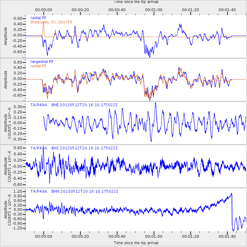
R49A Shelbyville, KY, USA - Earthquake Result Viewer
*The percent match for this event was below the threshold and hence no stack was calculated.
| Earthquake location: |
Fox Islands, Aleutian Islands |
| Earthquake latitude/longitude: |
52.5/-172.0 |
| Earthquake time(UTC): |
2013/05/12 (132) 20:06:41 GMT |
| Earthquake Depth: |
8.0 km |
| Earthquake Magnitude: |
5.7 MB, 5.1 MS, 5.4 MW, 5.3 MW |
| Earthquake Catalog/Contributor: |
WHDF/NEIC |
|
| Network: |
TA USArray Transportable Network (new EarthScope stations) |
| Station: |
R49A Shelbyville, KY, USA |
| Lat/Lon: |
38.29 N/85.17 W |
| Elevation: |
251 m |
|
| Distance: |
59.0 deg |
| Az: |
66.456 deg |
| Baz: |
314.581 deg |
| Ray Param: |
$rayparam |
*The percent match for this event was below the threshold and hence was not used in the summary stack. |
|
| Radial Match: |
66.769424 % |
| Radial Bump: |
400 |
| Transverse Match: |
63.6747 % |
| Transverse Bump: |
395 |
| SOD ConfigId: |
508211 |
| Insert Time: |
2013-07-12 10:16:52.779 +0000 |
| GWidth: |
2.5 |
| Max Bumps: |
400 |
| Tol: |
0.001 |
|
Signal To Noise
| Channel | StoN | STA | LTA |
| TA:R49A: :BHZ:20130512T20:16:10.175022Z | 2.189427 | 2.3932918E-7 | 1.09311344E-7 |
| TA:R49A: :BHN:20130512T20:16:10.175022Z | 2.1900291 | 3.5820895E-7 | 1.6356354E-7 |
| TA:R49A: :BHE:20130512T20:16:10.175022Z | 1.2670479 | 9.865744E-8 | 7.7864016E-8 |
| Arrivals |
| Ps | |
| PpPs | |
| PsPs/PpSs | |


