You are here: Home > Network List > GT - Global Telemetered Seismograph Network (USAF/USGS) Stations List
> Station LPAZ La Paz , Bolivia > Earthquake Result Viewer
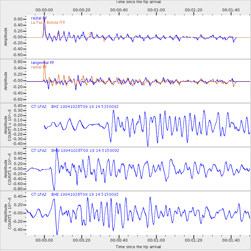
LPAZ La Paz , Bolivia - Earthquake Result Viewer

| Earthquake location: |
Off Coast Of Guerrero, Mexico |
| Earthquake latitude/longitude: |
14.6/-103.7 |
| Earthquake time(UTC): |
1994/10/28 (301) 09:11:20 GMT |
| Earthquake Depth: |
33 km |
| Earthquake Magnitude: |
5.5 MS, 5.2 MB |
| Earthquake Catalog/Contributor: |
WHDF/NEIC |
|
| Network: |
GT Global Telemetered Seismograph Network (USAF/USGS) |
| Station: |
LPAZ La Paz , Bolivia |
| Lat/Lon: |
16.29 S/68.13 W |
| Elevation: |
4769 m |
|
| Distance: |
46.6 deg |
| Az: |
129.74 deg |
| Baz: |
309.165 deg |
| Ray Param: |
0.07044927 |
| Estimated Moho Depth: |
64.0 km |
| Estimated Crust Vp/Vs: |
1.72 |
| Assumed Crust Vp: |
6.454 km/s |
| Estimated Crust Vs: |
3.747 km/s |
| Estimated Crust Poisson's Ratio: |
0.25 |
|
| Radial Match: |
83.899704 % |
| Radial Bump: |
339 |
| Transverse Match: |
69.18552 % |
| Transverse Bump: |
400 |
| SOD ConfigId: |
4480 |
| Insert Time: |
2010-02-27 02:10:36.233 +0000 |
| GWidth: |
2.5 |
| Max Bumps: |
400 |
| Tol: |
0.001 |
|
Signal To Noise
| Channel | StoN | STA | LTA |
| GT:LPAZ: :BHN:19941028T09:19:14.515009Z | 2.0650966 | 1.911173E-7 | 9.2546415E-8 |
| GT:LPAZ: :BHE:19941028T09:19:14.515009Z | 2.1962304 | 1.2708469E-7 | 5.786492E-8 |
| GT:LPAZ: :BHZ:19941028T09:19:14.515009Z | 1.1232852 | 6.5629955E-8 | 5.8426796E-8 |
| Arrivals |
| Ps | 7.6 SECOND |
| PpPs | 25 SECOND |
| PsPs/PpSs | 33 SECOND |


