
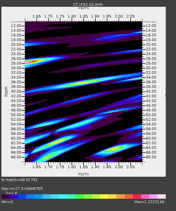
LPAZ La Paz , Bolivia - Earthquake Result Viewer
| ||||||||||||||||||
| ||||||||||||||||||
| ||||||||||||||||||
|
Signal To Noise
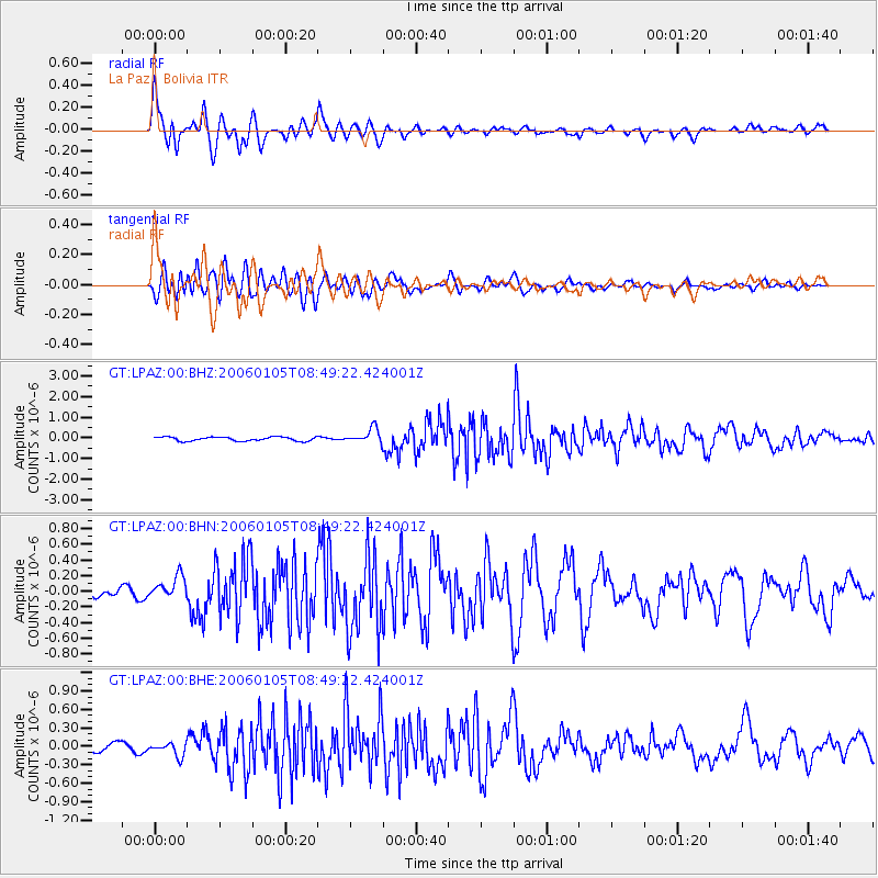
| Channel | StoN | STA | LTA |
| GT:LPAZ:00:BHN:20060105T08:49:22.424001Z | 2.1989844 | 1.4250476E-7 | 6.48048E-8 |
| GT:LPAZ:00:BHE:20060105T08:49:22.424001Z | 1.1029364 | 1.0929966E-7 | 9.909879E-8 |
| GT:LPAZ:00:BHZ:20060105T08:49:22.424001Z | 3.6971066 | 3.611739E-7 | 9.7690965E-8 |
| Arrivals | |
| Ps | 2.7 SECOND |
| PpPs | 10 SECOND |
| PsPs/PpSs | 13 SECOND |

