You are here: Home > Network List > CI - Caltech Regional Seismic Network Stations List
> Station FUR Furnace Creek, CA, USA > Earthquake Result Viewer
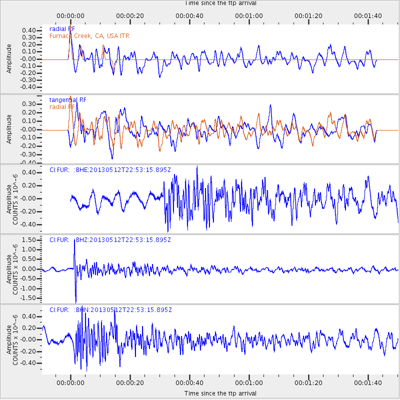
FUR Furnace Creek, CA, USA - Earthquake Result Viewer
*The percent match for this event was below the threshold and hence no stack was calculated.
| Earthquake location: |
Kuril Islands |
| Earthquake latitude/longitude: |
44.0/147.8 |
| Earthquake time(UTC): |
2013/05/12 (132) 22:42:45 GMT |
| Earthquake Depth: |
54 km |
| Earthquake Magnitude: |
5.6 MB, 5.2 MW, 5.1 MW |
| Earthquake Catalog/Contributor: |
WHDF/NEIC |
|
| Network: |
CI Caltech Regional Seismic Network |
| Station: |
FUR Furnace Creek, CA, USA |
| Lat/Lon: |
36.47 N/116.86 W |
| Elevation: |
-37.0 m |
|
| Distance: |
69.2 deg |
| Az: |
59.162 deg |
| Baz: |
309.717 deg |
| Ray Param: |
$rayparam |
*The percent match for this event was below the threshold and hence was not used in the summary stack. |
|
| Radial Match: |
72.487 % |
| Radial Bump: |
400 |
| Transverse Match: |
74.75937 % |
| Transverse Bump: |
400 |
| SOD ConfigId: |
508211 |
| Insert Time: |
2013-07-12 10:32:57.095 +0000 |
| GWidth: |
2.5 |
| Max Bumps: |
400 |
| Tol: |
0.001 |
|
Signal To Noise
| Channel | StoN | STA | LTA |
| CI:FUR: :BHZ:20130512T22:53:15.895Z | 6.480929 | 4.998439E-7 | 7.712534E-8 |
| CI:FUR: :BHN:20130512T22:53:15.895Z | 2.1500473 | 2.0729846E-7 | 9.641577E-8 |
| CI:FUR: :BHE:20130512T22:53:15.895Z | 2.1818697 | 1.8738007E-7 | 8.58805E-8 |
| Arrivals |
| Ps | |
| PpPs | |
| PsPs/PpSs | |


