
LPAZ La Paz , Bolivia - Earthquake Result Viewer
| ||||||||||||||||||
| ||||||||||||||||||
| ||||||||||||||||||
|
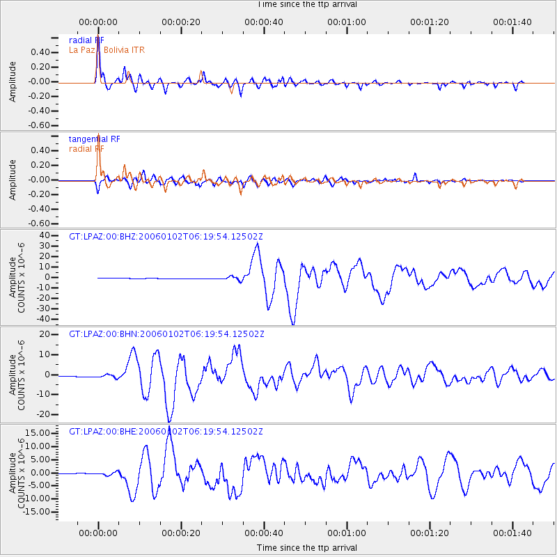
Signal To Noise
| Channel | StoN | STA | LTA |
| GT:LPAZ:00:BHN:20060102T06:19:54.12502Z | 5.4261746 | 7.705306E-7 | 1.4200255E-7 |
| GT:LPAZ:00:BHE:20060102T06:19:54.12502Z | 7.0602617 | 6.0486576E-7 | 8.5671864E-8 |
| GT:LPAZ:00:BHZ:20060102T06:19:54.12502Z | 8.211826 | 1.8442378E-6 | 2.2458315E-7 |
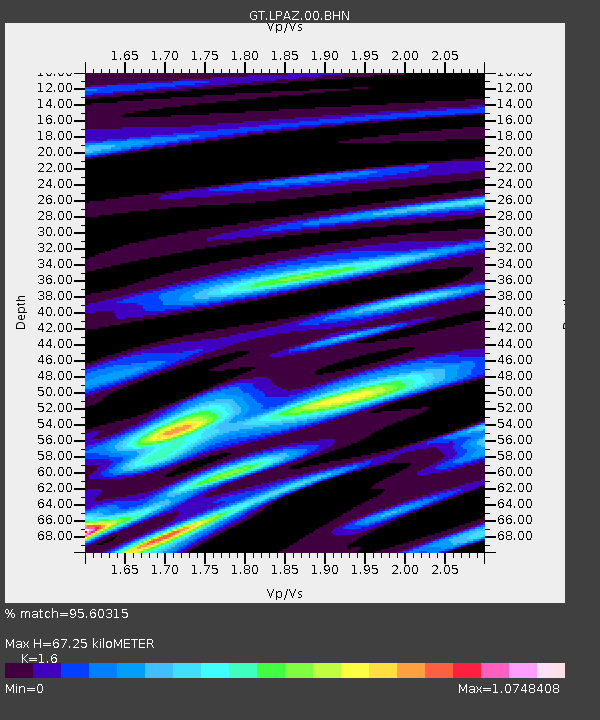
| Arrivals | |
| Ps | 6.6 SECOND |
| PpPs | 26 SECOND |
| PsPs/PpSs | 32 SECOND |

