You are here: Home > Network List > CI - Caltech Regional Seismic Network Stations List
> Station MPM Manuel Prospect Mine, California, USA > Earthquake Result Viewer
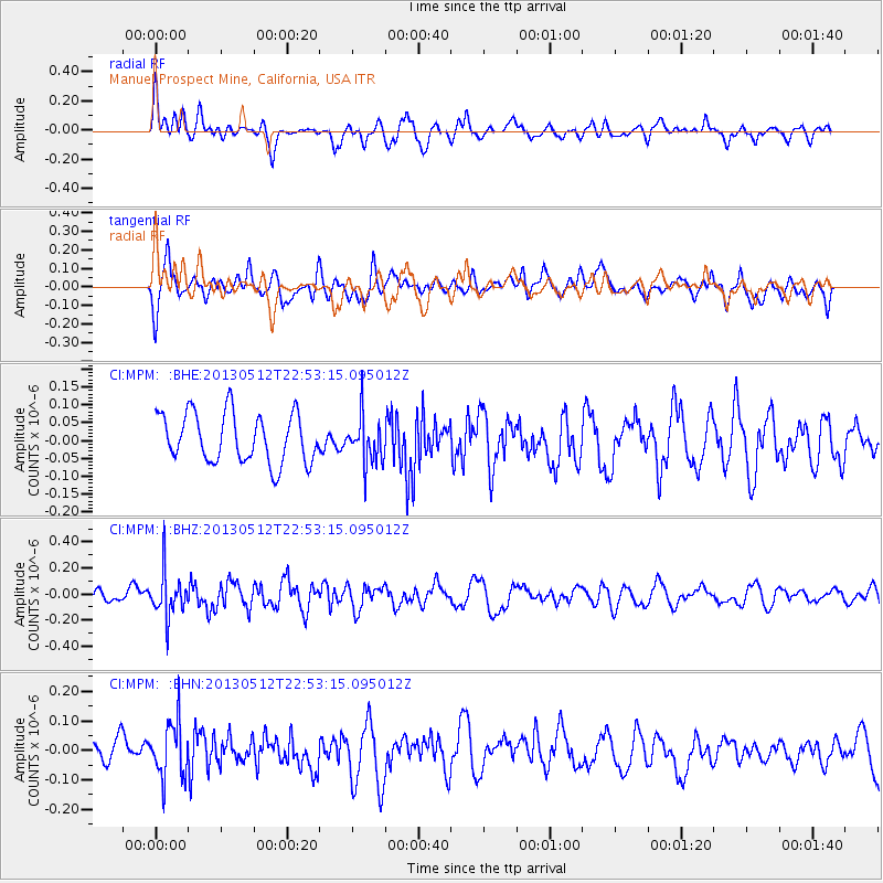
MPM Manuel Prospect Mine, California, USA - Earthquake Result Viewer
*The percent match for this event was below the threshold and hence no stack was calculated.
| Earthquake location: |
Kuril Islands |
| Earthquake latitude/longitude: |
44.0/147.8 |
| Earthquake time(UTC): |
2013/05/12 (132) 22:42:45 GMT |
| Earthquake Depth: |
54 km |
| Earthquake Magnitude: |
5.6 MB, 5.2 MW, 5.1 MW |
| Earthquake Catalog/Contributor: |
WHDF/NEIC |
|
| Network: |
CI Caltech Regional Seismic Network |
| Station: |
MPM Manuel Prospect Mine, California, USA |
| Lat/Lon: |
36.06 N/117.49 W |
| Elevation: |
185 m |
|
| Distance: |
69.1 deg |
| Az: |
59.844 deg |
| Baz: |
309.591 deg |
| Ray Param: |
$rayparam |
*The percent match for this event was below the threshold and hence was not used in the summary stack. |
|
| Radial Match: |
66.75413 % |
| Radial Bump: |
400 |
| Transverse Match: |
53.994015 % |
| Transverse Bump: |
400 |
| SOD ConfigId: |
508211 |
| Insert Time: |
2013-07-12 10:33:09.644 +0000 |
| GWidth: |
2.5 |
| Max Bumps: |
400 |
| Tol: |
0.001 |
|
Signal To Noise
| Channel | StoN | STA | LTA |
| CI:MPM: :BHZ:20130512T22:53:15.095012Z | 2.2061973 | 1.682701E-7 | 7.627156E-8 |
| CI:MPM: :BHN:20130512T22:53:15.095012Z | 2.2698934 | 9.5058475E-8 | 4.1877943E-8 |
| CI:MPM: :BHE:20130512T22:53:15.095012Z | 0.9503677 | 6.502077E-8 | 6.841643E-8 |
| Arrivals |
| Ps | |
| PpPs | |
| PsPs/PpSs | |


