
LPAZ La Paz , Bolivia - Earthquake Result Viewer
| ||||||||||||||||||
| ||||||||||||||||||
| ||||||||||||||||||
|
Signal To Noise
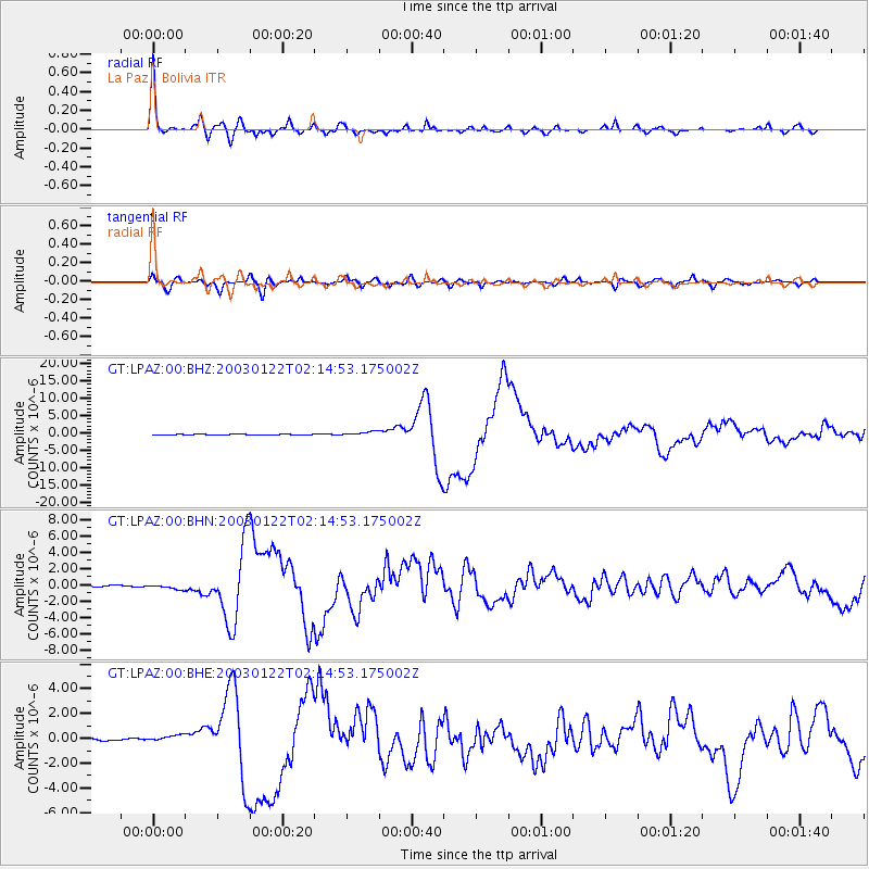
| Channel | StoN | STA | LTA |
| GT:LPAZ:00:BHN:20030122T02:14:53.175002Z | 2.7818403 | 3.0369648E-7 | 1.0917106E-7 |
| GT:LPAZ:00:BHE:20030122T02:14:53.175002Z | 2.8984492 | 2.7048253E-7 | 9.331974E-8 |
| GT:LPAZ:00:BHZ:20030122T02:14:53.175002Z | 7.294689 | 6.311314E-7 | 8.65193E-8 |
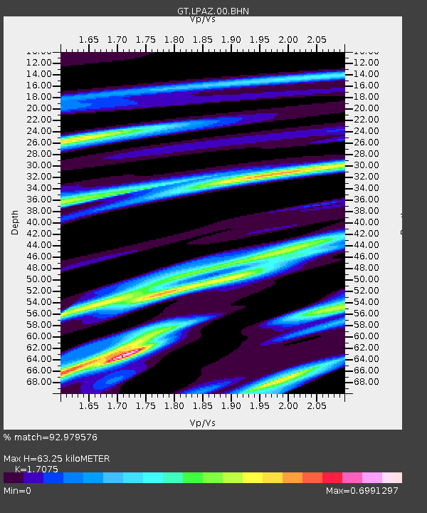
| Arrivals | |
| Ps | 7.4 SECOND |
| PpPs | 25 SECOND |
| PsPs/PpSs | 32 SECOND |

