You are here: Home > Network List > TA - USArray Transportable Network (new EarthScope stations) Stations List
> Station R41A Rosebud, MO, USA > Earthquake Result Viewer
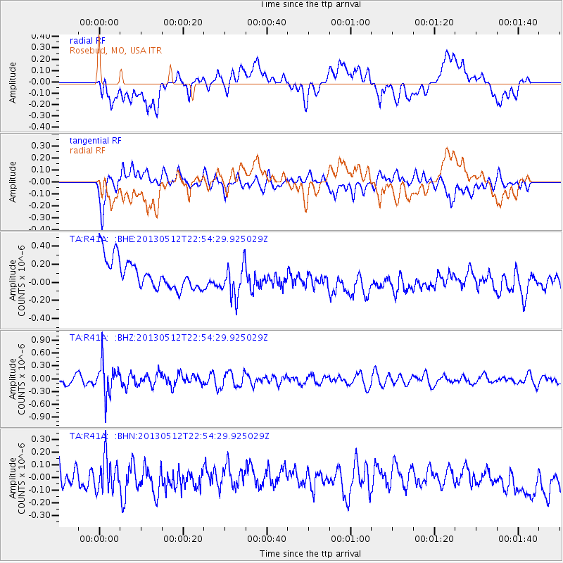
R41A Rosebud, MO, USA - Earthquake Result Viewer
*The percent match for this event was below the threshold and hence no stack was calculated.
| Earthquake location: |
Kuril Islands |
| Earthquake latitude/longitude: |
44.0/147.8 |
| Earthquake time(UTC): |
2013/05/12 (132) 22:42:45 GMT |
| Earthquake Depth: |
54 km |
| Earthquake Magnitude: |
5.6 MB, 5.2 MW, 5.1 MW |
| Earthquake Catalog/Contributor: |
WHDF/NEIC |
|
| Network: |
TA USArray Transportable Network (new EarthScope stations) |
| Station: |
R41A Rosebud, MO, USA |
| Lat/Lon: |
38.30 N/91.38 W |
| Elevation: |
257 m |
|
| Distance: |
82.2 deg |
| Az: |
43.005 deg |
| Baz: |
321.244 deg |
| Ray Param: |
$rayparam |
*The percent match for this event was below the threshold and hence was not used in the summary stack. |
|
| Radial Match: |
33.7684 % |
| Radial Bump: |
400 |
| Transverse Match: |
57.370495 % |
| Transverse Bump: |
400 |
| SOD ConfigId: |
508211 |
| Insert Time: |
2013-07-12 10:43:29.393 +0000 |
| GWidth: |
2.5 |
| Max Bumps: |
400 |
| Tol: |
0.001 |
|
Signal To Noise
| Channel | StoN | STA | LTA |
| TA:R41A: :BHZ:20130512T22:54:29.925029Z | 4.1145387 | 3.7474555E-7 | 9.107839E-8 |
| TA:R41A: :BHN:20130512T22:54:29.925029Z | 1.2579335 | 1.4539044E-7 | 1.155788E-7 |
| TA:R41A: :BHE:20130512T22:54:29.925029Z | 1.1970497 | 1.9389523E-7 | 1.619776E-7 |
| Arrivals |
| Ps | |
| PpPs | |
| PsPs/PpSs | |


