You are here: Home > Network List > TA - USArray Transportable Network (new EarthScope stations) Stations List
> Station P47A Martinsville, IN, USA > Earthquake Result Viewer
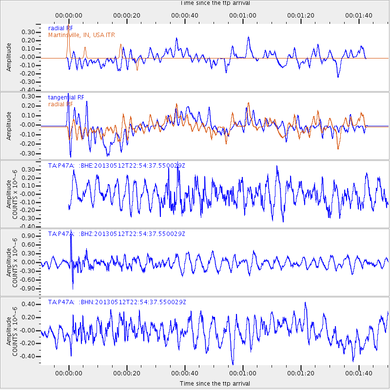
P47A Martinsville, IN, USA - Earthquake Result Viewer
*The percent match for this event was below the threshold and hence no stack was calculated.
| Earthquake location: |
Kuril Islands |
| Earthquake latitude/longitude: |
44.0/147.8 |
| Earthquake time(UTC): |
2013/05/12 (132) 22:42:45 GMT |
| Earthquake Depth: |
54 km |
| Earthquake Magnitude: |
5.6 MB, 5.2 MW, 5.1 MW |
| Earthquake Catalog/Contributor: |
WHDF/NEIC |
|
| Network: |
TA USArray Transportable Network (new EarthScope stations) |
| Station: |
P47A Martinsville, IN, USA |
| Lat/Lon: |
39.49 N/86.27 W |
| Elevation: |
246 m |
|
| Distance: |
83.7 deg |
| Az: |
39.087 deg |
| Baz: |
323.958 deg |
| Ray Param: |
$rayparam |
*The percent match for this event was below the threshold and hence was not used in the summary stack. |
|
| Radial Match: |
41.453445 % |
| Radial Bump: |
400 |
| Transverse Match: |
46.16618 % |
| Transverse Bump: |
400 |
| SOD ConfigId: |
508211 |
| Insert Time: |
2013-07-12 10:45:44.076 +0000 |
| GWidth: |
2.5 |
| Max Bumps: |
400 |
| Tol: |
0.001 |
|
Signal To Noise
| Channel | StoN | STA | LTA |
| TA:P47A: :BHZ:20130512T22:54:37.550029Z | 2.1382675 | 2.928397E-7 | 1.3695185E-7 |
| TA:P47A: :BHN:20130512T22:54:37.550029Z | 0.9887759 | 1.5120247E-7 | 1.5291884E-7 |
| TA:P47A: :BHE:20130512T22:54:37.550029Z | 0.9187912 | 1.1744258E-7 | 1.2782293E-7 |
| Arrivals |
| Ps | |
| PpPs | |
| PsPs/PpSs | |


