You are here: Home > Network List > TA - USArray Transportable Network (new EarthScope stations) Stations List
> Station X46A Booneville, MS, USA > Earthquake Result Viewer
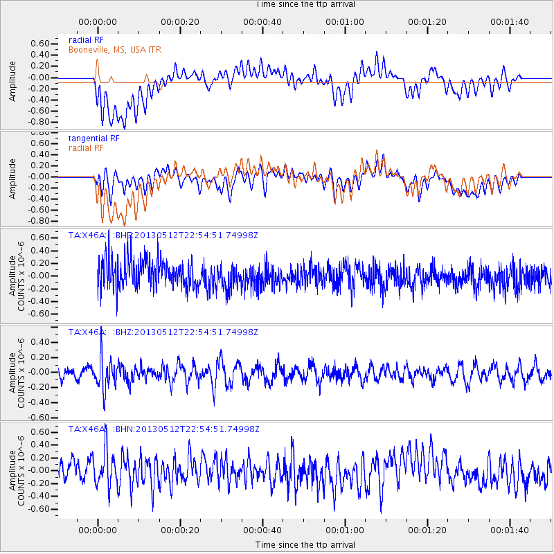
X46A Booneville, MS, USA - Earthquake Result Viewer
*The percent match for this event was below the threshold and hence no stack was calculated.
| Earthquake location: |
Kuril Islands |
| Earthquake latitude/longitude: |
44.0/147.8 |
| Earthquake time(UTC): |
2013/05/12 (132) 22:42:45 GMT |
| Earthquake Depth: |
54 km |
| Earthquake Magnitude: |
5.6 MB, 5.2 MW, 5.1 MW |
| Earthquake Catalog/Contributor: |
WHDF/NEIC |
|
| Network: |
TA USArray Transportable Network (new EarthScope stations) |
| Station: |
X46A Booneville, MS, USA |
| Lat/Lon: |
34.56 N/88.58 W |
| Elevation: |
150 m |
|
| Distance: |
86.5 deg |
| Az: |
43.522 deg |
| Baz: |
322.948 deg |
| Ray Param: |
$rayparam |
*The percent match for this event was below the threshold and hence was not used in the summary stack. |
|
| Radial Match: |
45.720585 % |
| Radial Bump: |
400 |
| Transverse Match: |
46.07125 % |
| Transverse Bump: |
400 |
| SOD ConfigId: |
508211 |
| Insert Time: |
2013-07-12 10:46:43.123 +0000 |
| GWidth: |
2.5 |
| Max Bumps: |
400 |
| Tol: |
0.001 |
|
Signal To Noise
| Channel | StoN | STA | LTA |
| TA:X46A: :BHZ:20130512T22:54:51.74998Z | 2.5559626 | 2.1264844E-7 | 8.3197015E-8 |
| TA:X46A: :BHN:20130512T22:54:51.74998Z | 1.4841756 | 2.9529673E-7 | 1.9896348E-7 |
| TA:X46A: :BHE:20130512T22:54:51.74998Z | 0.9182655 | 1.9725736E-7 | 2.1481517E-7 |
| Arrivals |
| Ps | |
| PpPs | |
| PsPs/PpSs | |


