You are here: Home > Network List > TA - USArray Transportable Network (new EarthScope stations) Stations List
> Station Z50A Ashland, AL, USA > Earthquake Result Viewer
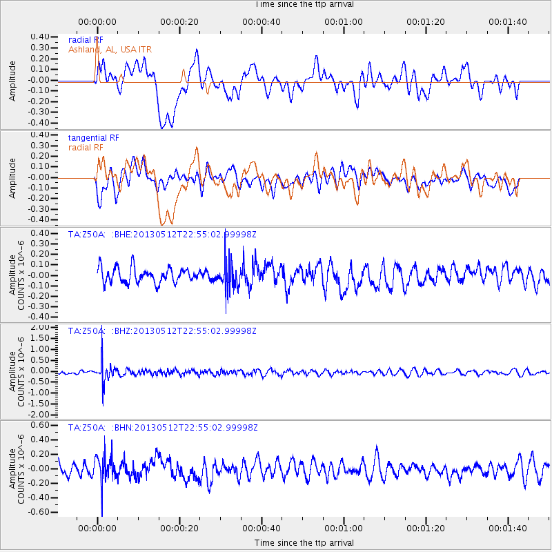
Z50A Ashland, AL, USA - Earthquake Result Viewer
*The percent match for this event was below the threshold and hence no stack was calculated.
| Earthquake location: |
Kuril Islands |
| Earthquake latitude/longitude: |
44.0/147.8 |
| Earthquake time(UTC): |
2013/05/12 (132) 22:42:45 GMT |
| Earthquake Depth: |
54 km |
| Earthquake Magnitude: |
5.6 MB, 5.2 MW, 5.1 MW |
| Earthquake Catalog/Contributor: |
WHDF/NEIC |
|
| Network: |
TA USArray Transportable Network (new EarthScope stations) |
| Station: |
Z50A Ashland, AL, USA |
| Lat/Lon: |
33.25 N/85.92 W |
| Elevation: |
370 m |
|
| Distance: |
88.9 deg |
| Az: |
42.507 deg |
| Baz: |
324.386 deg |
| Ray Param: |
$rayparam |
*The percent match for this event was below the threshold and hence was not used in the summary stack. |
|
| Radial Match: |
54.155495 % |
| Radial Bump: |
400 |
| Transverse Match: |
52.141933 % |
| Transverse Bump: |
400 |
| SOD ConfigId: |
508211 |
| Insert Time: |
2013-07-12 10:47:15.365 +0000 |
| GWidth: |
2.5 |
| Max Bumps: |
400 |
| Tol: |
0.001 |
|
Signal To Noise
| Channel | StoN | STA | LTA |
| TA:Z50A: :BHZ:20130512T22:55:02.99998Z | 7.0752344 | 4.7240619E-7 | 6.676898E-8 |
| TA:Z50A: :BHN:20130512T22:55:02.99998Z | 2.1397154 | 1.796557E-7 | 8.3962426E-8 |
| TA:Z50A: :BHE:20130512T22:55:02.99998Z | 1.7964253 | 1.259824E-7 | 7.012949E-8 |
| Arrivals |
| Ps | |
| PpPs | |
| PsPs/PpSs | |


