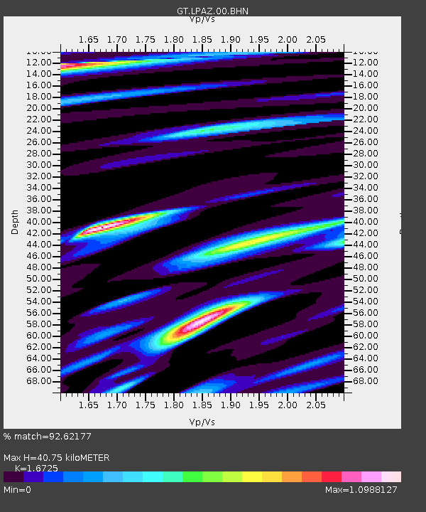
LPAZ La Paz , Bolivia - Earthquake Result Viewer
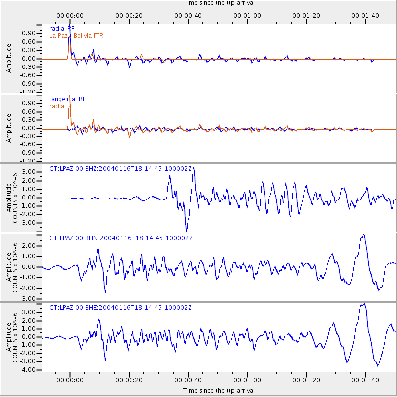
Earthquake location: Central Mid-Atlantic Ridge
Earthquake latitude/longitude: 7.6/-37.7
Earthquake time(UTC): 2004/01/16 (016) 18:07:55 GMT
Earthquake Depth: 10 km
Earthquake Magnitude: 5.9 MB, 6.0 MS, 6.2 MW, 6.2 MW
Earthquake Catalog/Contributor: WHDF/NEIC
Network: GT Global Telemetered Seismograph Network (USAF/USGS)
Station: LPAZ La Paz , Bolivia
Lat/Lon: 16.17 S/68.08 W
Elevation: 4817 m
Distance: 38.3 deg
Az: 231.688 deg
Baz: 54.038 deg
Ray Param: 0.075664125
Estimated Moho Depth: 40.75 km
Estimated Crust Vp/Vs: 1.67
Assumed Crust Vp: 6.454 km/s
Estimated Crust Vs: 3.859 km/s
Estimated Crust Poisson's Ratio: 0.22
Radial Match: 92.62177 %
Radial Bump: 287
Transverse Match: 83.45533 %
Transverse Bump: 400
SOD ConfigId: 2459
Insert Time: 2010-02-27 02:11:29.070 +0000
GWidth: 2.5
Max Bumps: 400
Tol: 0.001

Signal To Noise

ChannelStoNSTALTA
GT:LPAZ:00:BHN:20040116T18:14:45.100002Z4.2160624.802908E-71.13919285E-7
GT:LPAZ:00:BHE:20040116T18:14:45.100002Z5.6243925.057049E-78.991282E-8
GT:LPAZ:00:BHZ:20040116T18:14:45.100002Z10.7414049.993736E-79.303938E-8
Arrivals
Ps4.6 SECOND
PpPs16 SECOND
PsPs/PpSs20 SECOND