You are here: Home > Network List > TA - USArray Transportable Network (new EarthScope stations) Stations List
> Station W49A Belvidere, TN, USA > Earthquake Result Viewer
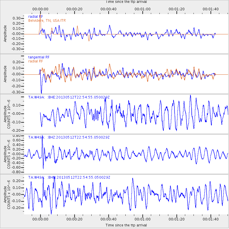
W49A Belvidere, TN, USA - Earthquake Result Viewer
*The percent match for this event was below the threshold and hence no stack was calculated.
| Earthquake location: |
Kuril Islands |
| Earthquake latitude/longitude: |
44.0/147.8 |
| Earthquake time(UTC): |
2013/05/12 (132) 22:42:45 GMT |
| Earthquake Depth: |
54 km |
| Earthquake Magnitude: |
5.6 MB, 5.2 MW, 5.1 MW |
| Earthquake Catalog/Contributor: |
WHDF/NEIC |
|
| Network: |
TA USArray Transportable Network (new EarthScope stations) |
| Station: |
W49A Belvidere, TN, USA |
| Lat/Lon: |
35.12 N/86.26 W |
| Elevation: |
251 m |
|
| Distance: |
87.2 deg |
| Az: |
41.65 deg |
| Baz: |
324.165 deg |
| Ray Param: |
$rayparam |
*The percent match for this event was below the threshold and hence was not used in the summary stack. |
|
| Radial Match: |
50.45431 % |
| Radial Bump: |
400 |
| Transverse Match: |
62.095432 % |
| Transverse Bump: |
400 |
| SOD ConfigId: |
508211 |
| Insert Time: |
2013-07-12 10:48:52.872 +0000 |
| GWidth: |
2.5 |
| Max Bumps: |
400 |
| Tol: |
0.001 |
|
Signal To Noise
| Channel | StoN | STA | LTA |
| TA:W49A: :BHZ:20130512T22:54:55.050029Z | 2.1390576 | 2.8181756E-7 | 1.3174846E-7 |
| TA:W49A: :BHN:20130512T22:54:55.050029Z | 1.2967137 | 1.0067728E-7 | 7.764033E-8 |
| TA:W49A: :BHE:20130512T22:54:55.050029Z | 0.68402433 | 4.230306E-8 | 6.1844375E-8 |
| Arrivals |
| Ps | |
| PpPs | |
| PsPs/PpSs | |


