You are here: Home > Network List > TA - USArray Transportable Network (new EarthScope stations) Stations List
> Station L46A Eue Claire, MI, USA > Earthquake Result Viewer
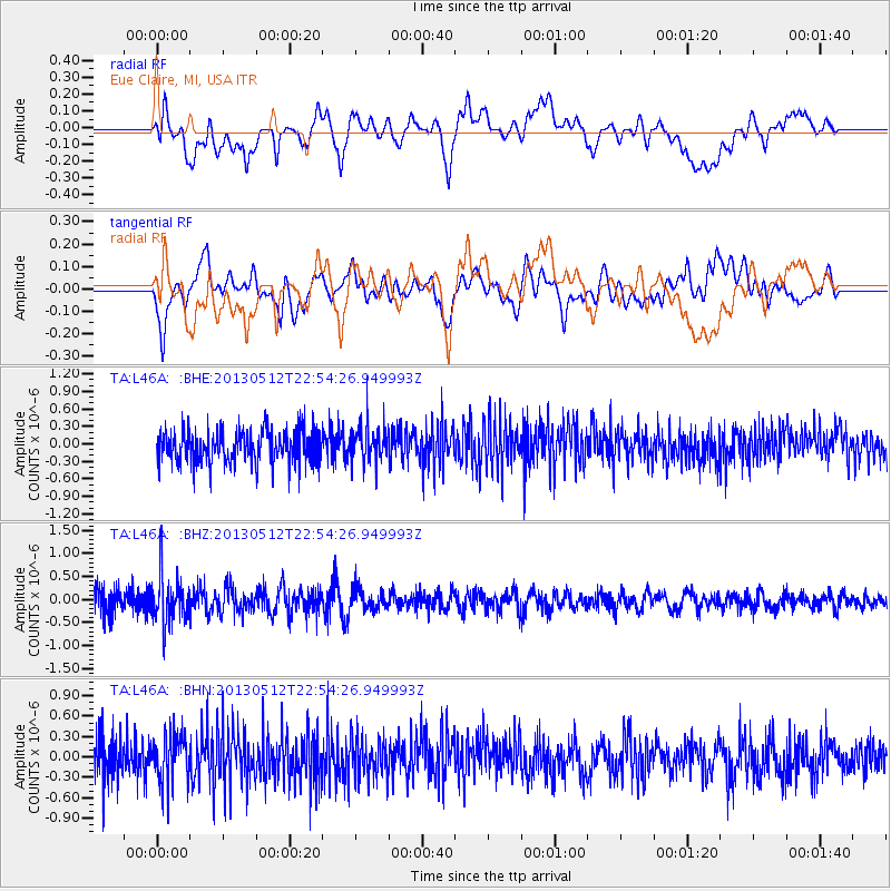
L46A Eue Claire, MI, USA - Earthquake Result Viewer
*The percent match for this event was below the threshold and hence no stack was calculated.
| Earthquake location: |
Kuril Islands |
| Earthquake latitude/longitude: |
44.0/147.8 |
| Earthquake time(UTC): |
2013/05/12 (132) 22:42:45 GMT |
| Earthquake Depth: |
54 km |
| Earthquake Magnitude: |
5.6 MB, 5.2 MW, 5.1 MW |
| Earthquake Catalog/Contributor: |
WHDF/NEIC |
|
| Network: |
TA USArray Transportable Network (new EarthScope stations) |
| Station: |
L46A Eue Claire, MI, USA |
| Lat/Lon: |
42.01 N/86.30 W |
| Elevation: |
223 m |
|
| Distance: |
81.6 deg |
| Az: |
37.602 deg |
| Baz: |
323.751 deg |
| Ray Param: |
$rayparam |
*The percent match for this event was below the threshold and hence was not used in the summary stack. |
|
| Radial Match: |
51.74619 % |
| Radial Bump: |
400 |
| Transverse Match: |
50.324005 % |
| Transverse Bump: |
400 |
| SOD ConfigId: |
508211 |
| Insert Time: |
2013-07-12 10:51:43.375 +0000 |
| GWidth: |
2.5 |
| Max Bumps: |
400 |
| Tol: |
0.001 |
|
Signal To Noise
| Channel | StoN | STA | LTA |
| TA:L46A: :BHZ:20130512T22:54:26.949993Z | 2.0709467 | 5.32553E-7 | 2.5715434E-7 |
| TA:L46A: :BHN:20130512T22:54:26.949993Z | 1.3690195 | 3.4659166E-7 | 2.5316783E-7 |
| TA:L46A: :BHE:20130512T22:54:26.949993Z | 1.1101726 | 3.141041E-7 | 2.829327E-7 |
| Arrivals |
| Ps | |
| PpPs | |
| PsPs/PpSs | |


