You are here: Home > Network List > TA - USArray Transportable Network (new EarthScope stations) Stations List
> Station O03E Paynes Creek, CA, USA > Earthquake Result Viewer
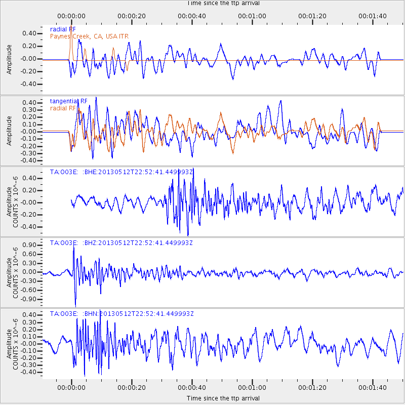
O03E Paynes Creek, CA, USA - Earthquake Result Viewer
*The percent match for this event was below the threshold and hence no stack was calculated.
| Earthquake location: |
Kuril Islands |
| Earthquake latitude/longitude: |
44.0/147.8 |
| Earthquake time(UTC): |
2013/05/12 (132) 22:42:45 GMT |
| Earthquake Depth: |
54 km |
| Earthquake Magnitude: |
5.6 MB, 5.2 MW, 5.1 MW |
| Earthquake Catalog/Contributor: |
WHDF/NEIC |
|
| Network: |
TA USArray Transportable Network (new EarthScope stations) |
| Station: |
O03E Paynes Creek, CA, USA |
| Lat/Lon: |
40.29 N/121.80 W |
| Elevation: |
967 m |
|
| Distance: |
63.8 deg |
| Az: |
58.493 deg |
| Baz: |
306.393 deg |
| Ray Param: |
$rayparam |
*The percent match for this event was below the threshold and hence was not used in the summary stack. |
|
| Radial Match: |
56.471233 % |
| Radial Bump: |
400 |
| Transverse Match: |
46.799812 % |
| Transverse Bump: |
400 |
| SOD ConfigId: |
508211 |
| Insert Time: |
2013-07-12 10:52:07.049 +0000 |
| GWidth: |
2.5 |
| Max Bumps: |
400 |
| Tol: |
0.001 |
|
Signal To Noise
| Channel | StoN | STA | LTA |
| TA:O03E: :BHZ:20130512T22:52:41.449993Z | 9.788804 | 3.773319E-7 | 3.8547295E-8 |
| TA:O03E: :BHN:20130512T22:52:41.449993Z | 3.0536377 | 1.8740185E-7 | 6.137004E-8 |
| TA:O03E: :BHE:20130512T22:52:41.449993Z | 2.3826993 | 1.7459826E-7 | 7.3277505E-8 |
| Arrivals |
| Ps | |
| PpPs | |
| PsPs/PpSs | |


