
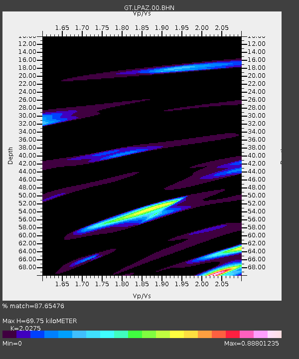
LPAZ La Paz , Bolivia - Earthquake Result Viewer
| ||||||||||||||||||
| ||||||||||||||||||
| ||||||||||||||||||
|
Signal To Noise
| Channel | StoN | STA | LTA |
| GT:LPAZ:00:BHN:20050224T05:03:22.474014Z | 2.2876487 | 1.237053E-7 | 5.4075304E-8 |
| GT:LPAZ:00:BHE:20050224T05:03:22.474014Z | 5.7513676 | 1.9989147E-7 | 3.475547E-8 |
| GT:LPAZ:00:BHZ:20050224T05:03:22.474014Z | 8.023177 | 4.333319E-7 | 5.4010012E-8 |
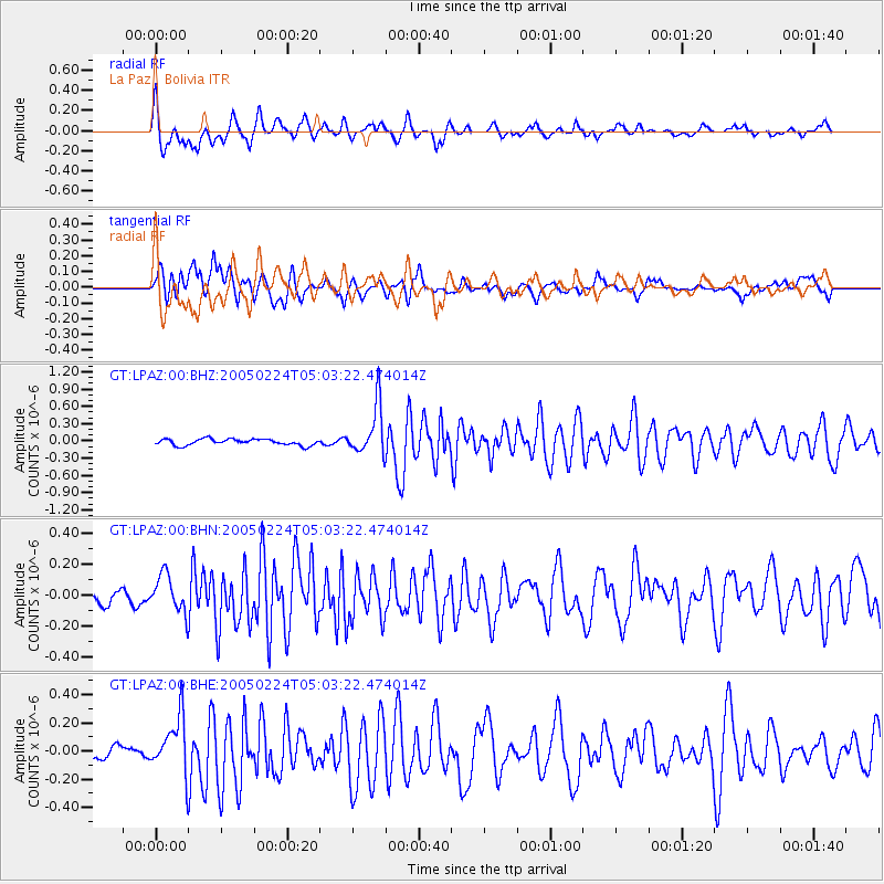
| Arrivals | |
| Ps | 12 SECOND |
| PpPs | 31 SECOND |
| PsPs/PpSs | 43 SECOND |

