You are here: Home > Network List > TA - USArray Transportable Network (new EarthScope stations) Stations List
> Station I64A Boothbay, ME, USA > Earthquake Result Viewer
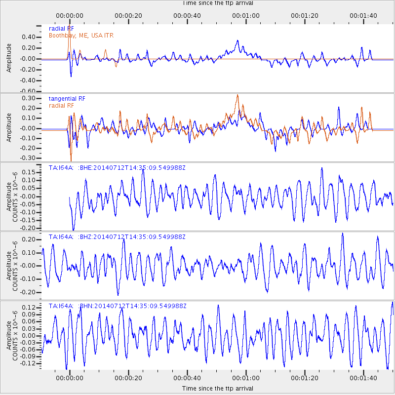
I64A Boothbay, ME, USA - Earthquake Result Viewer
*The percent match for this event was below the threshold and hence no stack was calculated.
| Earthquake location: |
Near Coast Of Peru |
| Earthquake latitude/longitude: |
-15.2/-75.6 |
| Earthquake time(UTC): |
2014/07/12 (193) 14:25:41 GMT |
| Earthquake Depth: |
16 km |
| Earthquake Magnitude: |
5.0 MW, 4.9 mb, 5.4 ML |
| Earthquake Catalog/Contributor: |
ISC/ISC |
|
| Network: |
TA USArray Transportable Network (new EarthScope stations) |
| Station: |
I64A Boothbay, ME, USA |
| Lat/Lon: |
43.92 N/69.63 W |
| Elevation: |
17 m |
|
| Distance: |
59.1 deg |
| Az: |
5.025 deg |
| Baz: |
186.721 deg |
| Ray Param: |
$rayparam |
*The percent match for this event was below the threshold and hence was not used in the summary stack. |
|
| Radial Match: |
51.14465 % |
| Radial Bump: |
400 |
| Transverse Match: |
52.848835 % |
| Transverse Bump: |
400 |
| SOD ConfigId: |
3390531 |
| Insert Time: |
2019-04-12 19:44:36.540 +0000 |
| GWidth: |
2.5 |
| Max Bumps: |
400 |
| Tol: |
0.001 |
|
Signal To Noise
| Channel | StoN | STA | LTA |
| TA:I64A: :BHZ:20140712T14:35:09.549988Z | 0.46315143 | 4.64707E-8 | 1.00335875E-7 |
| TA:I64A: :BHN:20140712T14:35:09.549988Z | 1.4195342 | 9.826177E-8 | 6.922114E-8 |
| TA:I64A: :BHE:20140712T14:35:09.549988Z | 0.72255915 | 4.896349E-8 | 6.7763985E-8 |
| Arrivals |
| Ps | |
| PpPs | |
| PsPs/PpSs | |


