You are here: Home > Network List > TA - USArray Transportable Network (new EarthScope stations) Stations List
> Station R54A Victor, WV, USA > Earthquake Result Viewer
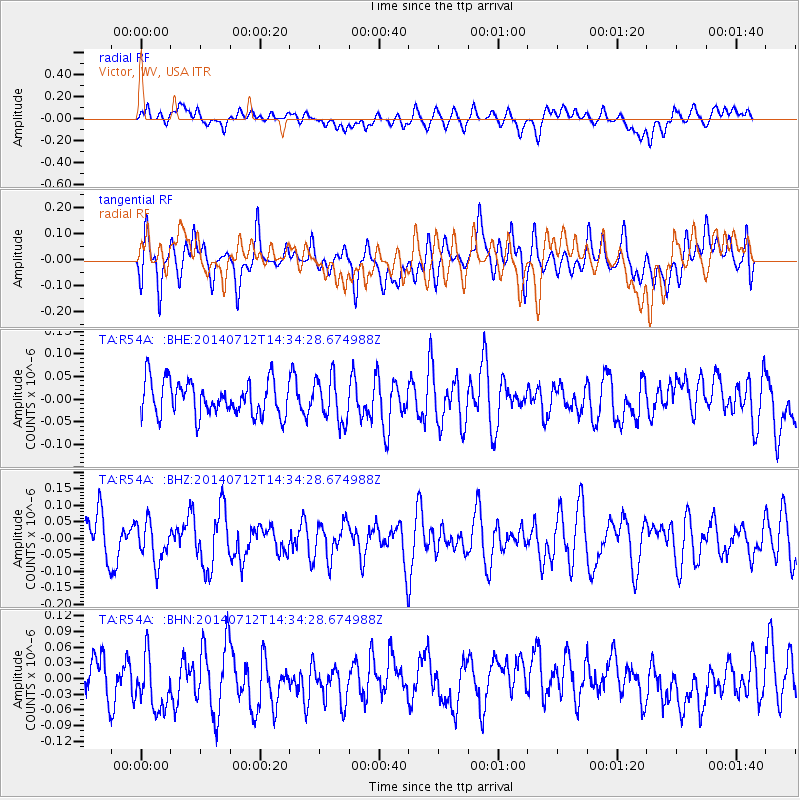
R54A Victor, WV, USA - Earthquake Result Viewer
*The percent match for this event was below the threshold and hence no stack was calculated.
| Earthquake location: |
Near Coast Of Peru |
| Earthquake latitude/longitude: |
-15.2/-75.6 |
| Earthquake time(UTC): |
2014/07/12 (193) 14:25:41 GMT |
| Earthquake Depth: |
16 km |
| Earthquake Magnitude: |
5.0 MW, 4.9 mb, 5.4 ML |
| Earthquake Catalog/Contributor: |
ISC/ISC |
|
| Network: |
TA USArray Transportable Network (new EarthScope stations) |
| Station: |
R54A Victor, WV, USA |
| Lat/Lon: |
38.18 N/80.99 W |
| Elevation: |
512 m |
|
| Distance: |
53.3 deg |
| Az: |
354.707 deg |
| Baz: |
173.511 deg |
| Ray Param: |
$rayparam |
*The percent match for this event was below the threshold and hence was not used in the summary stack. |
|
| Radial Match: |
46.354553 % |
| Radial Bump: |
400 |
| Transverse Match: |
45.843323 % |
| Transverse Bump: |
400 |
| SOD ConfigId: |
3390531 |
| Insert Time: |
2019-04-12 19:45:02.306 +0000 |
| GWidth: |
2.5 |
| Max Bumps: |
400 |
| Tol: |
0.001 |
|
Signal To Noise
| Channel | StoN | STA | LTA |
| TA:R54A: :BHZ:20140712T14:34:28.674988Z | 1.0447342 | 6.1525384E-8 | 5.8890947E-8 |
| TA:R54A: :BHN:20140712T14:34:28.674988Z | 1.5002848 | 6.119536E-8 | 4.0789164E-8 |
| TA:R54A: :BHE:20140712T14:34:28.674988Z | 1.2878351 | 4.867684E-8 | 3.7797417E-8 |
| Arrivals |
| Ps | |
| PpPs | |
| PsPs/PpSs | |


