You are here: Home > Network List > TA - USArray Transportable Network (new EarthScope stations) Stations List
> Station S60A Water View, VA, USA > Earthquake Result Viewer
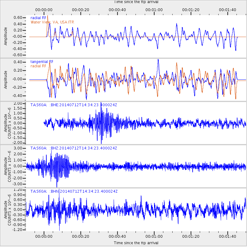
S60A Water View, VA, USA - Earthquake Result Viewer
*The percent match for this event was below the threshold and hence no stack was calculated.
| Earthquake location: |
Near Coast Of Peru |
| Earthquake latitude/longitude: |
-15.2/-75.6 |
| Earthquake time(UTC): |
2014/07/12 (193) 14:25:41 GMT |
| Earthquake Depth: |
16 km |
| Earthquake Magnitude: |
5.0 MW, 4.9 mb, 5.4 ML |
| Earthquake Catalog/Contributor: |
ISC/ISC |
|
| Network: |
TA USArray Transportable Network (new EarthScope stations) |
| Station: |
S60A Water View, VA, USA |
| Lat/Lon: |
37.42 N/76.39 W |
| Elevation: |
36 m |
|
| Distance: |
52.3 deg |
| Az: |
359.207 deg |
| Baz: |
179.038 deg |
| Ray Param: |
$rayparam |
*The percent match for this event was below the threshold and hence was not used in the summary stack. |
|
| Radial Match: |
49.74753 % |
| Radial Bump: |
400 |
| Transverse Match: |
53.78507 % |
| Transverse Bump: |
400 |
| SOD ConfigId: |
3390531 |
| Insert Time: |
2019-04-12 19:45:09.552 +0000 |
| GWidth: |
2.5 |
| Max Bumps: |
400 |
| Tol: |
0.001 |
|
Signal To Noise
| Channel | StoN | STA | LTA |
| TA:S60A: :BHZ:20140712T14:34:23.400024Z | 2.3879075 | 1.0355012E-6 | 4.3364378E-7 |
| TA:S60A: :BHN:20140712T14:34:23.400024Z | 1.2294333 | 3.715467E-7 | 3.022097E-7 |
| TA:S60A: :BHE:20140712T14:34:23.400024Z | 3.014344 | 8.2654225E-7 | 2.7420302E-7 |
| Arrivals |
| Ps | |
| PpPs | |
| PsPs/PpSs | |


