You are here: Home > Network List > IU - Global Seismograph Network (GSN - IRIS/USGS) Stations List
> Station HNR Honiara, Solomon Islands > Earthquake Result Viewer
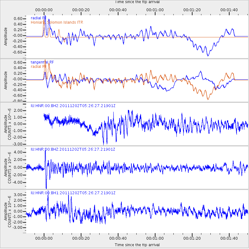
HNR Honiara, Solomon Islands - Earthquake Result Viewer
*The percent match for this event was below the threshold and hence no stack was calculated.
| Earthquake location: |
Minahassa Peninsula, Sulawesi |
| Earthquake latitude/longitude: |
0.1/120.5 |
| Earthquake time(UTC): |
2011/12/02 (336) 05:19:26 GMT |
| Earthquake Depth: |
75 km |
| Earthquake Magnitude: |
5.5 MW, 5.5 MW, 5.9 MB |
| Earthquake Catalog/Contributor: |
NEIC PDE/NEIC PDE-W |
|
| Network: |
IU Global Seismograph Network (GSN - IRIS/USGS) |
| Station: |
HNR Honiara, Solomon Islands |
| Lat/Lon: |
9.44 S/159.95 E |
| Elevation: |
100 m |
|
| Distance: |
40.4 deg |
| Az: |
104.705 deg |
| Baz: |
281.379 deg |
| Ray Param: |
$rayparam |
*The percent match for this event was below the threshold and hence was not used in the summary stack. |
|
| Radial Match: |
48.26324 % |
| Radial Bump: |
400 |
| Transverse Match: |
48.651802 % |
| Transverse Bump: |
400 |
| SOD ConfigId: |
510226 |
| Insert Time: |
2013-09-04 18:55:32.971 +0000 |
| GWidth: |
2.5 |
| Max Bumps: |
400 |
| Tol: |
0.001 |
|
Signal To Noise
| Channel | StoN | STA | LTA |
| IU:HNR:00:BHZ:20111202T05:26:27.21901Z | 4.375882 | 2.0573184E-6 | 4.7014942E-7 |
| IU:HNR:00:BH1:20111202T05:26:27.21901Z | 2.2269084 | 1.0098623E-6 | 4.5348173E-7 |
| IU:HNR:00:BH2:20111202T05:26:27.21901Z | 2.9439046 | 1.5112034E-6 | 5.13333E-7 |
| Arrivals |
| Ps | |
| PpPs | |
| PsPs/PpSs | |


